Earthquake PHILIPPINE ISLANDS REGION
Tue, 13 Jan 2026 10:12:47 GMT
Time1 month ago
Location
5.9500, 127.0800
Depth
24.0 KM
Event Summary
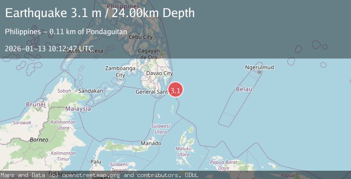
A 3.1 magnitude earthquake struck on PHILIPPINE ISLANDS REGION, at Tue, 13 Jan 2026 10:12:47 GMT. Depth: 24km. Reviewed by PIVS seismologists, this minor quake occurred at a magnitude type of m.
Magnitude
3.1
m
Source
PIVS
Intensity
-
Agency Reports
1 Sources| Source | Magnitude | Depth | Time |
|---|---|---|---|
| PIVSPrimary | 3.1 | 24 km | 1 month ago |
Earthquake Details
AutomaticEvent IDemsc_PIVS_20260113_0000141
Tsunami PotentialNo
Magnitude Typem
Nearest Places
- Tanjung Dapapa69.1 km
- Desa Pulau Miangas70.1 km
- Pulau Miangas70.2 km
- Kecamatan Miangas70.2 km
- Miangas70.9 km
Comments
Join the discussion about this event.
Latest Earthquakes
4.2Mag
Java, Indonesia
Time3 minutes ago
Depth95.46 km
SourceVYT (Automatic)
1.6Mag
Sumbawa region, Indonesia
Time3 minutes ago
Depth11.47 km
SourceVYT (Automatic)
3.0Mag
southern Sumatra, Indonesia
Time4 minutes ago
Depth37.96 km
SourceVYT (Automatic)
3.1Mag
Near North Coast of West Papua
Time7 minutes ago
Depth10.00 km
SourceBMKG
3.1Mag
Sweden
Time12 minutes ago
Depth0.00 km
SourceVYT (Automatic)
Nearby Earthquakes
5.0Mag
PHILIPPINE ISLANDS REGION
Time11 years ago
Depth106.00 km
SourceEMSC (Automatic)
3.0Mag
PHILIPPINE ISLANDS REGION
Time5 years ago
Depth108.00 km
SourcePIVS (Automatic)
3.0Mag
PHILIPPINE ISLANDS REGION
Time1 year ago
Depth1.00 km
SourcePIVS (Automatic)
5.4Mag
PHILIPPINE ISLANDS REGION
Time13 years ago
Depth142.00 km
SourceEMSC (Automatic)
3.0Mag
PHILIPPINE ISLANDS REGION
Time4 years ago
Depth119.00 km
SourcePIVS (Automatic)