Earthquake MORO GULF, MINDANAO, PHILIPPINES
Sun, 01 Feb 2026 04:06:09 GMT
Time2 weeks ago
Location
6.4500, 123.7600
Depth
18.0 KM
Event Summary
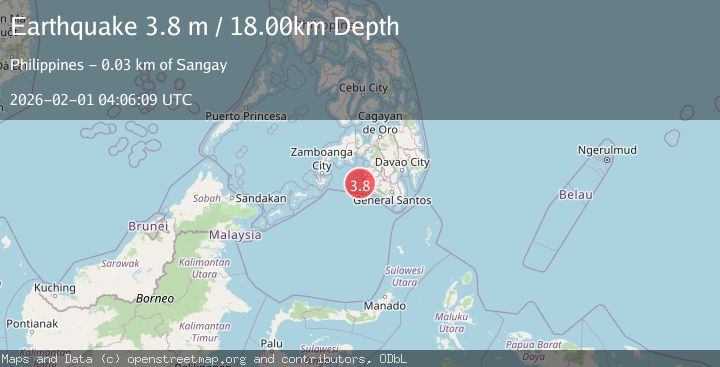
A 3.8 magnitude earthquake struck on MORO GULF, MINDANAO, PHILIPPINES, at Sun, 01 Feb 2026 04:06:09 GMT. Depth: 18km. Reviewed by PIVS seismologists, this minor quake occurred at a magnitude type of m.
Magnitude
3.8
m
Source
PIVS
Intensity
-
Agency Reports
1 Sources| Source | Magnitude | Depth | Time |
|---|---|---|---|
| PIVSPrimary | 3.8 | 18 km | 2 weeks ago |
Earthquake Details
AutomaticEvent IDemsc_PIVS_20260201_0000062
Tsunami PotentialNo
Magnitude Typem
Nearest Places
- Donaung Shoals26.3 km
- Donauang Island29.0 km
- Basiauang Bay29.7 km
- Danawan Point29.9 km
- Basiauang Point30.0 km
Comments
Join the discussion about this event.
Latest Earthquakes
2.7Mag
near the coast of Tarapaca, Chile
Time11 hours ago
Depth2.08 km
SourceVYT (Automatic)
0.9Mag
17 km S of Little Lake, CA
Time11 hours ago
Depth1.71 km
SourceUSGS (Automatic)
3.4Mag
OKLAHOMA
Time11 hours ago
Depth0.40 km
SourceOK (Automatic)
3.2Mag
Oklahoma
Time11 hours ago
Depth138.92 km
SourceVYT (Automatic)
1.6Mag
Southern Alaska
Time11 hours ago
Depth17.82 km
SourceVYT (Automatic)
Nearby Earthquakes
3.6Mag
MORO GULF, MINDANAO, PHILIPPINES
Time0 months ago
Depth6.00 km
SourcePIVS (Automatic)
4.2Mag
MORO GULF, MINDANAO, PHILIPPINES
Time0 months ago
Depth10.00 km
SourcePIVS (Automatic)
4.1Mag
MORO GULF, MINDANAO, PHILIPPINES
Time1 month ago
Depth3.00 km
SourcePIVS (Automatic)
3.7Mag
MORO GULF, MINDANAO, PHILIPPINES
Time2 weeks ago
Depth5.00 km
SourcePIVS (Automatic)
3.0Mag
MORO GULF, MINDANAO, PHILIPPINES
Time0 months ago
Depth9.00 km
SourcePIVS (Automatic)