Earthquake DOMINICAN REPUBLIC REGION
Mon, 26 Oct 2020 06:52:01 GMT
Time5 years ago
Location
18.0900, -69.7400
Depth
125.0 KM
Event Summary
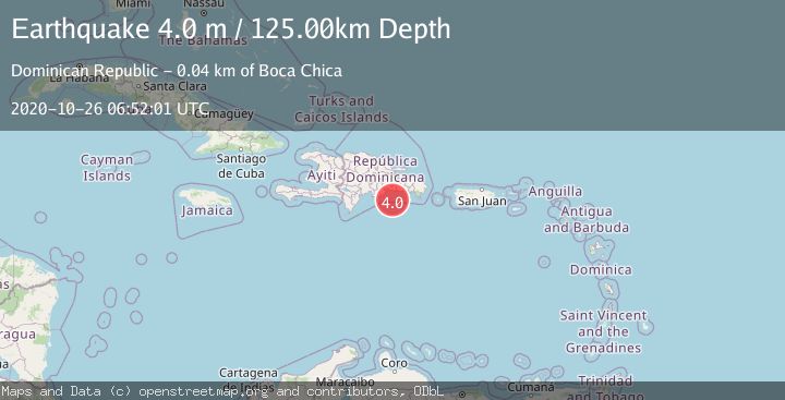
A 4.0 magnitude earthquake struck on DOMINICAN REPUBLIC REGION, at Mon, 26 Oct 2020 06:52:01 GMT. Depth: 125km. Reviewed by UASD seismologists, this light quake occurred at a magnitude type of m.
Magnitude
4.0
m
Source
UASD
Intensity
-
Agency Reports
1 Sources| Source | Magnitude | Depth | Time |
|---|---|---|---|
| UASDPrimary | 4.0 | 125 km | 5 years ago |
Earthquake Details
AutomaticEvent IDemsc_UASD_20201026_0000154
Tsunami PotentialNo
Magnitude Typem
Nearest Places
- Cañada Matía2.6 km
- Santo Domingo Basin26.8 km
- El Ranchito35.3 km
- Punta La Calavera36.3 km
- El Sordo36.4 km
Comments
Join the discussion about this event.
Latest Earthquakes
3.7Mag
Kepulauan Tanimbar, Indonesia
Time10 minutes ago
Depth10.00 km
SourceVYT (Automatic)
4.6Mag
West Papua Region, Indonesia
Time10 minutes ago
Depth24.86 km
SourceBMKG
1.5Mag
35 km SE of Minto, Alaska
Time14 minutes ago
Depth0.10 km
SourceUSGS (Automatic)
3.7Mag
Banda Sea
Time14 minutes ago
Depth237.55 km
SourceVYT (Automatic)
2.2Mag
AEGEAN SEA
Time15 minutes ago
Depth12.80 km
SourceKOERI (Automatic)
Nearby Earthquakes
3.0Mag
DOMINICAN REPUBLIC REGION
Time3 years ago
Depth24.00 km
SourceUASD (Automatic)
3.0Mag
DOMINICAN REPUBLIC REGION
Time7 months ago
Depth50.10 km
SourceUASD (Automatic)
3.0Mag
DOMINICAN REPUBLIC REGION
Time5 years ago
Depth130.00 km
SourceUASD (Automatic)
3.0Mag
DOMINICAN REPUBLIC REGION
Time7 months ago
Depth36.30 km
SourceUASD (Automatic)
3.0Mag
DOMINICAN REPUBLIC REGION
Time5 years ago
Depth50.00 km
SourceUASD (Automatic)