Earthquake 24 km SW of Anchor Point, Alaska
Thu, 01 Jan 2026 12:54:59 GMT
Time1 hour ago
Location
59.6120, -152.1300
Depth
62.2 KM
Event Summary
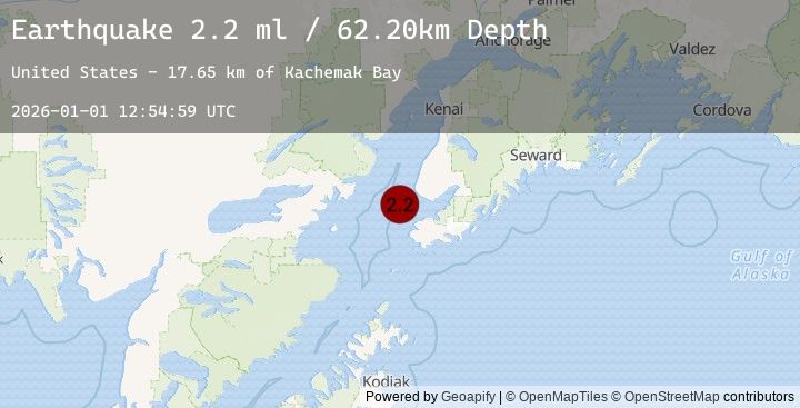
A 2.2 magnitude earthquake struck on 24 km SW of Anchor Point, Alaska, at Thu, 01 Jan 2026 12:54:59 GMT. Depth: 62.2km. Reviewed by USGS seismologists, this minor quake occurred at a magnitude type of ml.
Magnitude
2.2
ml
Source
USGS
Intensity
-
Earthquake Details
AutomaticEvent IDusgs_ak2026aazrvt
Tsunami PotentialNo
Magnitude Typeml
Nearest Places
- Kachemak Bay17.6 km
- Mutnaia Gulch21.0 km
- Travers Creek21.1 km
- Troublesome Creek21.7 km
- Anchor Point Light22.8 km
Comments
Join the discussion about this event.
Latest Earthquakes
2.0Mag
68 km WNW of Karluk, Alaska
Time1 hour ago
Depth84.90 km
SourceUSGS (Automatic)
1.4Mag
CENTRAL TURKEY
Time1 hour ago
Depth13.00 km
SourceEMSC (Automatic)
1.3Mag
WESTERN TURKEY
Time1 hour ago
Depth7.00 km
SourceEMSC (Automatic)
4.9Mag
ZULIA, VENEZUELA
Time1 hour ago
Depth18.00 km
SourceEMSC (Automatic)
2.3Mag
WESTERN AUSTRALIA
Time1 hour ago
Depth1.00 km
SourceEMSC (Automatic)
Nearby Earthquakes
2.8Mag
33 km SW of Nanwalek, Alaska
Time4 hours ago
Depth62.90 km
SourceUSGS (Automatic)
2.1Mag
60 km ENE of Pedro Bay, Alaska
Time4 hours ago
Depth127.30 km
SourceUSGS (Automatic)
1.9Mag
43 km WSW of Anchor Point, Alaska
Time13 hours ago
Depth71.10 km
SourceUSGS (Automatic)
4.0Mag
SOUTHERN ALASKA
Time17 hours ago
Depth101.20 km
SourceEMSC (Automatic)
3.7Mag
62 km W of Happy Valley, Alaska
Time17 hours ago
Depth116.10 km
SourceUSGS (Automatic)