Earthquake 50 km W of Karluk, Alaska
Thu, 01 Jan 2026 14:12:33 GMT
Time4 hours ago
Location
57.6410, -155.2820
Depth
70.6 KM
Event Summary
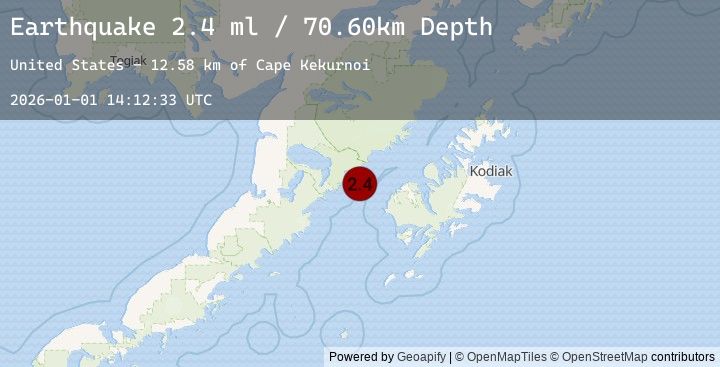
A 2.4 magnitude earthquake struck on 50 km W of Karluk, Alaska, at Thu, 01 Jan 2026 14:12:33 GMT. Depth: 70.6km. Reviewed by USGS seismologists, this minor quake occurred at a magnitude type of ml.
Magnitude
2.4
ml
Source
USGS
Intensity
-
Earthquake Details
AutomaticEvent IDusgs_ak2026abcfzn
Tsunami PotentialNo
Magnitude Typeml
Nearest Places
- Cape Kekurnoi9.5 km
- Moose Creek15.3 km
- Little Alinchak Bay15.4 km
- Little Alinchak Creek17.4 km
- Helen Creek17.5 km
Comments
Join the discussion about this event.
Latest Earthquakes
1.2Mag
8 km NW of The Geysers, CA
Time3 hours ago
Depth1.91 km
SourceUSGS (Automatic)
2.5Mag
Java, Indonesia
Time3 hours ago
Depth26.00 km
SourceBMKG (Automatic)
2.6Mag
JAVA, INDONESIA
Time3 hours ago
Depth43.00 km
SourceEMSC (Automatic)
2.8Mag
SOUTH OF JAVA, INDONESIA
Time3 hours ago
Depth30.00 km
SourceEMSC (Automatic)
2.9Mag
CZECH REPUBLIC
Time3 hours ago
Depth12.00 km
SourceEMSC (Automatic)
Nearby Earthquakes
2.2Mag
30 km NNE of Karluk, Alaska
Time4 hours ago
Depth56.60 km
SourceUSGS (Automatic)
2.5Mag
48 km W of Karluk, Alaska
Time4 hours ago
Depth68.20 km
SourceUSGS (Automatic)
1.5Mag
58 km N of Karluk, Alaska
Time5 hours ago
Depth5.00 km
SourceUSGS (Automatic)
2.0Mag
68 km WNW of Karluk, Alaska
Time6 hours ago
Depth84.90 km
SourceUSGS (Automatic)
1.4Mag
80 km N of Karluk, Alaska
Time9 hours ago
Depth5.00 km
SourceUSGS (Automatic)