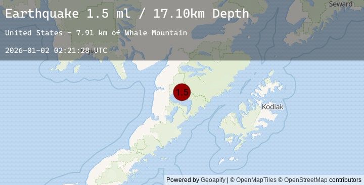
Earthquake 61 km E of Egegik, Alaska
Fri, 02 Jan 2026 02:21:28 GMT
Time5 hours ago
Location
58.1160, -156.3420
Depth
17.1 KM
Event Summary
A 2.5 magnitude earthquake struck on 61 km E of Egegik, Alaska, at Fri, 02 Jan 2026 02:21:28 GMT. Depth: 17.1km. Reviewed by USGS seismologists, this minor quake occurred at a magnitude type of ml.
Magnitude
2.5
ml
Source
USGS
Intensity
-
Agency Reports
3 Sources| Source | Magnitude | Depth | Time |
|---|---|---|---|
| USGSPrimary | 1.5 | 17 km | 5 hours ago |
| USGSPrimary | 2.5 | 5 km | 5 hours ago |
| USGSPrimary | 2.2 | 5 km | 5 hours ago |
Earthquake Details
AutomaticEvent IDusgs_ak2026acakuc
Tsunami PotentialNo
Magnitude Typeml
Nearest Places
- Whale Mountain7.9 km
- Granite Creek9.2 km
- Gertrude Creek9.9 km
- Becharof National Wildlife Refuge16.5 km
- Takayofo Creek20.3 km
Comments
Join the discussion about this event.
Latest Earthquakes
3.3Mag
ISLAND OF HAWAII, HAWAII
Time20 minutes ago
Depth30.70 km
SourceHV (Automatic)
2.5Mag
CRETE, GREECE
Time25 minutes ago
Depth31.60 km
SourceNOA (Automatic)
1.4Mag
24 km SSE of Midland, Texas
Time28 minutes ago
Depth4.29 km
SourceUSGS (Automatic)
1.4Mag
EASTERN TURKEY
Time30 minutes ago
Depth11.60 km
SourceEMSC (Automatic)
2.2Mag
19 km NNW of Fillmore, CA
Time40 minutes ago
Depth-1.09 km
SourceUSGS (Automatic)
Nearby Earthquakes
1.6Mag
72 km W of Karluk, Alaska
Time12 hours ago
Depth17.20 km
SourceUSGS (Automatic)
2.5Mag
48 km W of Karluk, Alaska
Time18 hours ago
Depth68.20 km
SourceUSGS (Automatic)
2.4Mag
50 km W of Karluk, Alaska
Time18 hours ago
Depth70.60 km
SourceUSGS (Automatic)
2.0Mag
68 km WNW of Karluk, Alaska
Time19 hours ago
Depth84.90 km
SourceUSGS (Automatic)
1.4Mag
80 km N of Karluk, Alaska
Time22 hours ago
Depth5.00 km
SourceUSGS (Automatic)