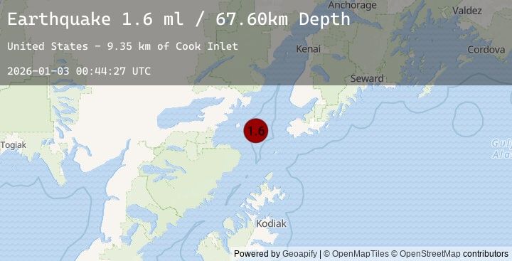
Earthquake 54 km W of Nanwalek, Alaska
Sat, 03 Jan 2026 00:44:27 GMT
Time1 hour ago
Location
59.2860, -152.8740
Depth
67.6 KM
Event Summary
A 1.8 magnitude earthquake struck on 54 km W of Nanwalek, Alaska, at Sat, 03 Jan 2026 00:44:27 GMT. Depth: 67.6km. Reviewed by USGS seismologists, this minor quake occurred at a magnitude type of ml.
Magnitude
1.8
ml
Source
USGS
Intensity
-
Agency Reports
4 Sources| Source | Magnitude | Depth | Time |
|---|---|---|---|
| USGSPrimary | 1.6 | 68 km | 1 hour ago |
| USGSPrimary | 0.5 | 5 km | 1 hour ago |
| USGSPrimary | 0.2 | 3 km | 1 hour ago |
| USGSPrimary | 1.8 | 127 km | 1 hour ago |
Earthquake Details
AutomaticEvent IDusgs_ak2026adsybu
Tsunami PotentialNo
Magnitude Typeml
Nearest Places
- Cook Inlet9.3 km
- Jakolof Bay27.9 km
- Augustine Rocks29.2 km
- Augustine Volcano32.8 km
- Augustine Island33.6 km
Comments
Join the discussion about this event.
Latest Earthquakes
1.1Mag
7 km N of Running Springs, CA
Time3 minutes ago
Depth7.50 km
SourceUSGS (Automatic)
2.3Mag
South of Java, Indonesia
Time15 minutes ago
Depth50.27 km
SourceBMKG (Automatic)
2.7Mag
AEGEAN SEA
Time19 minutes ago
Depth6.70 km
SourceKOERI (Automatic)
3.0Mag
Java, Indonesia
Time24 minutes ago
Depth10.80 km
SourceBMKG (Automatic)
5.0Mag
Java Sea
Time26 minutes ago
Depth19.94 km
SourceBMKG (Automatic)