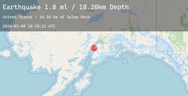
Earthquake 14 km WSW of Salamatof, Alaska
Fri, 09 Jan 2026 10:18:22 GMT
Time2 days ago
Location
60.5460, -151.5340
Depth
18.2 KM
Event Summary
A 1.8 magnitude earthquake struck on 14 km WSW of Salamatof, Alaska, at Fri, 09 Jan 2026 10:18:22 GMT. Depth: 18.2km. Reviewed by USGS seismologists, this minor quake occurred at a magnitude type of ml.
Magnitude
1.8
ml
Source
USGS
Intensity
-
Agency Reports
1 Sources| Source | Magnitude | Depth | Time |
|---|---|---|---|
| USGSPrimary | 1.8 | 18 km | 2 days ago |
Earthquake Details
AutomaticEvent IDusgs_ak2026apmhyd
Tsunami PotentialNo
Magnitude Typeml
Nearest Places
- Salmo Rock10.3 km
- Henley Airport12.5 km
- Salamatof Creek13.4 km
- Karluk Reef13.4 km
- Wildwood Correctional Complex13.4 km
Comments
Join the discussion about this event.
Latest Earthquakes
2.7Mag
Sulawesi, Indonesia
Time2 days ago
Depth2.58 km
SourceBMKG (Automatic)
1.9Mag
SPAIN
Time2 days ago
Depth23.30 km
SourceIGN (Automatic)
2.3Mag
Sumbawa Region, Indonesia
Time2 days ago
Depth1.52 km
SourceBMKG (Automatic)
2.6Mag
MOLUCCA SEA
Time2 days ago
Depth30.00 km
SourceBMKG (Automatic)
2.8Mag
SOUTH DAKOTA
Time2 days ago
Depth5.10 km
SourceNEIC (Automatic)