Earthquake 100 km NNW of Yakutat, Alaska
Tue, 13 Jan 2026 00:18:05 GMT
Time3 hours ago
Location
60.3100, -140.6890
Depth
5.0 KM
Event Summary
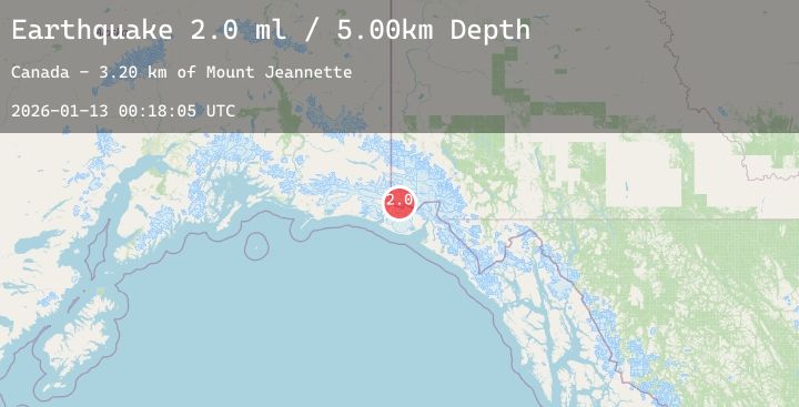
A 2.0 magnitude earthquake struck on 100 km NNW of Yakutat, Alaska, at Tue, 13 Jan 2026 00:18:05 GMT. Depth: 5km. Reviewed by USGS seismologists, this minor quake occurred at a magnitude type of ml.
Magnitude
2.0
ml
Source
USGS
Intensity
-
Agency Reports
1 Sources| Source | Magnitude | Depth | Time |
|---|---|---|---|
| USGSPrimary | 2.0 | 5 km | 3 hours ago |
Earthquake Details
AutomaticEvent IDusgs_ak2026awbidt
Tsunami PotentialNo
Magnitude Typeml
Nearest Places
- Mount Jeannette3.2 km
- Newton Glacier3.5 km
- Mount Bering4.6 km
- Mount Malaspina6.2 km
- Boundary Peak 1857.3 km
Comments
Join the discussion about this event.
Latest Earthquakes
1.4Mag
1 km NNW of Middletown, CA
Time3 hours ago
Depth7.23 km
SourceUSGS (Automatic)
3.1Mag
NEAR EAST COAST OF HONSHU, JAPAN
Time3 hours ago
Depth30.00 km
SourceJMA (Automatic)
2.2Mag
Sumbawa Region, Indonesia
Time3 hours ago
Depth10.00 km
SourceBMKG (Automatic)
1.5Mag
STRAIT OF GIBRALTAR
Time3 hours ago
Depth10.50 km
SourceIGN (Automatic)
1.6Mag
EASTERN TURKEY
Time3 hours ago
Depth7.00 km
SourceAFAD (Automatic)