Earthquake 57 km E of Egegik, Alaska
Fri, 16 Jan 2026 03:25:38 GMT
Time2 hours ago
Location
58.1900, -156.4030
Depth
10.5 KM
Event Summary
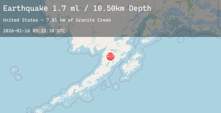
A 2.2 magnitude earthquake struck on 57 km E of Egegik, Alaska, at Fri, 16 Jan 2026 03:25:38 GMT. Depth: 10.5km. Reviewed by USGS seismologists, this minor quake occurred at a magnitude type of ml.
Magnitude
2.2
ml
Source
USGS
Intensity
-
Agency Reports
2 Sources| Source | Magnitude | Depth | Time |
|---|---|---|---|
| USGSPrimary | 1.7 | 11 km | 2 hours ago |
| USGSPrimary | 2.2 | 16 km | 1 hour ago |
Earthquake Details
AutomaticEvent IDusgs_ak2026bbuskq
Tsunami PotentialNo
Magnitude Typeml
Nearest Places
- Granite Creek7.8 km
- Gertrude Creek11.4 km
- Whale Mountain16.6 km
- Takayofo Creek23.4 km
- Contact Creek23.4 km
Comments
Join the discussion about this event.
Latest Earthquakes
2.8Mag
Sumbawa Region, Indonesia
Time5 minutes ago
Depth10.00 km
SourceBMKG (Automatic)
2.5Mag
Minahassa Peninsula, Sulawesi
Time10 minutes ago
Depth5.00 km
SourceBMKG (Automatic)
0.5Mag
9 km NNW of Idyllwild, CA
Time15 minutes ago
Depth9.94 km
SourceUSGS (Automatic)
2.3Mag
PUERTO RICO REGION
Time19 minutes ago
Depth14.30 km
SourcePR (Automatic)
3.3Mag
NEW MEXICO
Time20 minutes ago
Depth10.00 km
SourceNEIC (Automatic)