Earthquake 42 km SE of Denali National Park, Alaska
Sat, 17 Jan 2026 04:24:17 GMT
Time3 hours ago
Location
63.2800, -151.1020
Depth
0.3 KM
Event Summary
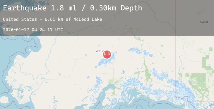
A 1.8 magnitude earthquake struck on 42 km SE of Denali National Park, Alaska, at Sat, 17 Jan 2026 04:24:17 GMT. Depth: 0.3km. Reviewed by USGS seismologists, this minor quake occurred at a magnitude type of ml.
Magnitude
1.8
ml
Source
USGS
Intensity
-
Agency Reports
1 Sources| Source | Magnitude | Depth | Time |
|---|---|---|---|
| USGSPrimary | 1.8 | 0 km | 3 hours ago |
Earthquake Details
AutomaticEvent IDusgs_ak2026bdsjvl
Tsunami PotentialNo
Magnitude Typeml
Nearest Places
- McLeod Lake10.4 km
- Jeffery Dome13.3 km
- Carlson Creek14.0 km
- Gunsight Pass15.0 km
- Gunsight Mountain15.0 km
Comments
Join the discussion about this event.
Latest Earthquakes
1.2Mag
NORTHERN ITALY
Time2 hours ago
Depth5.50 km
SourceETHZ (Automatic)
2.5Mag
Halmahera, Indonesia
Time2 hours ago
Depth70.26 km
SourceBMKG (Automatic)
3.3Mag
COQUIMBO, CHILE
Time2 hours ago
Depth125.90 km
SourceCSN (Automatic)
2.6Mag
Java, Indonesia
Time2 hours ago
Depth10.00 km
SourceBMKG (Automatic)
1.1Mag
2 km S of Highland Park, CA
Time3 hours ago
Depth9.17 km
SourceUSGS (Automatic)
Nearby Earthquakes
2.0Mag
44 km W of Cantwell, Alaska
Time5 hours ago
Depth101.80 km
SourceUSGS (Automatic)
2.1Mag
14 km W of Petersville, Alaska
Time6 hours ago
Depth72.80 km
SourceUSGS (Automatic)
2.1Mag
57 km NNW of Petersville, Alaska
Time14 hours ago
Depth121.90 km
SourceUSGS
1.6Mag
50 km WNW of Petersville, Alaska
Time21 hours ago
Depth0.30 km
SourceUSGS (Automatic)
3.3Mag
27 km ESE of Denali National Park, Alaska
Time22 hours ago
Depth1.80 km
SourceUSGS (Automatic)