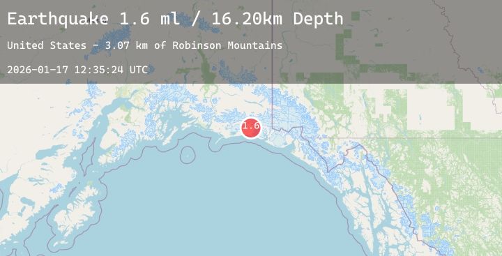
Earthquake 126 km SSE of McCarthy, Alaska
Sat, 17 Jan 2026 12:35:25 GMT
Time2 hours ago
Location
60.3290, -142.3920
Depth
6.1 KM
Event Summary
A 1.8 magnitude earthquake struck on 126 km SSE of McCarthy, Alaska, at Sat, 17 Jan 2026 12:35:25 GMT. Depth: 6.1km. Reviewed by USGS seismologists, this minor quake occurred at a magnitude type of ml.
Magnitude
1.8
ml
Source
USGS
Intensity
-
Agency Reports
1 Sources| Source | Magnitude | Depth | Time |
|---|---|---|---|
| USGSPrimary | 1.8 | 6 km | 2 hours ago |
Earthquake Details
AutomaticEvent IDusgs_ak2026beirap
Tsunami PotentialNo
Magnitude Typeml
Nearest Places
- Robinson Mountains4.6 km
- Kuleska Glacier9.2 km
- Barkley Ridge12.4 km
- Mount Miller13.4 km
- Robinson Mountains14.1 km
Comments
Join the discussion about this event.
Latest Earthquakes
2.4Mag
Bali Sea
Time6 minutes ago
Depth6.76 km
SourceBMKG (Automatic)
3.9Mag
Banda Sea
Time10 minutes ago
Depth175.48 km
SourceBMKG (Automatic)
2.8Mag
Seram, Indonesia
Time11 minutes ago
Depth10.00 km
SourceBMKG (Automatic)
2.4Mag
91 km NNW of Yakutat, Alaska
Time11 minutes ago
Depth5.00 km
SourceUSGS (Automatic)
2.1Mag
Java, Indonesia
Time23 minutes ago
Depth119.23 km
SourceBMKG (Automatic)
Nearby Earthquakes
No significant earthquakes nearby recently.