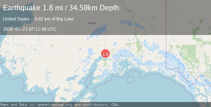
Earthquake 9 km NNE of Sterling, Alaska
Fri, 23 Jan 2026 07:08:56 GMT
Time4 days ago
Location
60.6120, -150.6740
Depth
64.3 KM
Event Summary
A 1.8 magnitude earthquake struck on 9 km NNE of Sterling, Alaska, at Fri, 23 Jan 2026 07:08:56 GMT. Depth: 64.3km. Reviewed by USGS seismologists, this minor quake occurred at a magnitude type of ml.
Magnitude
1.8
ml
Source
USGS
Intensity
-
Agency Reports
1 Sources| Source | Magnitude | Depth | Time |
|---|---|---|---|
| USGSPrimary | 1.8 | 35 km | 4 days ago |
Earthquake Details
AutomaticEvent IDusgs_ak2026boyfaa
Tsunami PotentialNo
Magnitude Typeml
Nearest Places
- Beaver Pond Lake1.1 km
- Grebe Lake1.8 km
- Yearling Lake3.1 km
- West Fork Moose River3.1 km
- Meadow Lake3.5 km
Comments
Join the discussion about this event.
Latest Earthquakes
3.8Mag
EASTERN TURKEY
Time7 minutes ago
Depth0.00 km
SourceKOERI (Automatic)
2.7Mag
West Papua Region, Indonesia
Time10 minutes ago
Depth14.59 km
SourceBMKG (Automatic)
2.1Mag
Flores Region, Indonesia
Time13 minutes ago
Depth10.00 km
SourceBMKG (Automatic)
3.7Mag
LA RIOJA, ARGENTINA
Time20 minutes ago
Depth119.00 km
SourceNSNA (Automatic)
2.2Mag
Savu Sea
Time22 minutes ago
Depth56.18 km
SourceBMKG (Automatic)
Nearby Earthquakes
2.4Mag
2 km WSW of Funny River, Alaska
Time4 days ago
Depth50.60 km
SourceUSGS (Automatic)
2.6Mag
4 km W of Funny River, Alaska
Time6 days ago
Depth1.30 km
SourceUSGS (Automatic)
1.8Mag
27 km ENE of Sterling, Alaska
Time4 days ago
Depth53.80 km
SourceUSGS (Automatic)
2.0Mag
27 km ENE of Sterling, Alaska
Time4 days ago
Depth47.80 km
SourceUSGS (Automatic)
2.2Mag
4 km SSE of Kasilof, Alaska
Time4 days ago
Depth54.20 km
SourceUSGS (Automatic)