Earthquake 42 km ESE of King Salmon, Alaska
Fri, 23 Jan 2026 21:04:44 GMT
Time1 week ago
Location
58.5830, -155.9580
Depth
175.7 KM
Event Summary
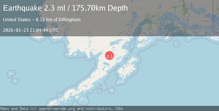
A 2.3 magnitude earthquake struck on 42 km ESE of King Salmon, Alaska, at Fri, 23 Jan 2026 21:04:44 GMT. Depth: 175.7km. Reviewed by USGS seismologists, this minor quake occurred at a magnitude type of ml.
Magnitude
2.3
ml
Source
USGS
Intensity
-
Agency Reports
1 Sources| Source | Magnitude | Depth | Time |
|---|---|---|---|
| USGSPrimary | 2.3 | 176 km | 1 week ago |
Earthquake Details
AutomaticEvent IDusgs_ak2026bpzxeg
Tsunami PotentialNo
Magnitude Typeml
Nearest Places
- Dumpling Mountain5.8 km
- Naknek Lake6.1 km
- Lake Brooks9.0 km
- Brooks Lodge Seaplane Base9.6 km
- Brooks Falls10.2 km
Comments
Join the discussion about this event.
Latest Earthquakes
2.1Mag
NEAR THE COAST OF WESTERN TURKEY
Time2 hours ago
Depth6.30 km
SourceKOERI (Automatic)
3.2Mag
Southern Sumatra, Indonesia
Time2 hours ago
Depth25.26 km
SourceBMKG (Automatic)
4.0Mag
ALBANIA
Time2 hours ago
Depth9.70 km
SourceNOA (Automatic)
3.7Mag
GUATEMALA
Time3 hours ago
Depth169.00 km
SourceINET (Automatic)
2.3Mag
Java, Indonesia
Time3 hours ago
Depth56.24 km
SourceBMKG (Automatic)
Nearby Earthquakes
1.0Mag
67 km ESE of King Salmon, Alaska
Time3 hours ago
Depth129.50 km
SourceUSGS (Automatic)
0.6Mag
93 km ESE of King Salmon, Alaska
Time1 week ago
Depth2.90 km
SourceUSGS (Automatic)
0.6Mag
88 km NW of Karluk, Alaska
Time1 week ago
Depth5.00 km
SourceUSGS (Automatic)
0.8Mag
86 km NW of Karluk, Alaska
Time4 days ago
Depth5.00 km
SourceUSGS (Automatic)
1.3Mag
86 km NW of Karluk, Alaska
Time2 days ago
Depth5.00 km
SourceUSGS (Automatic)