Earthquake 61 km W of Anchor Point, Alaska
Mon, 26 Jan 2026 11:52:32 GMT
Time22 hours ago
Location
59.8180, -152.9240
Depth
97.8 KM
Event Summary
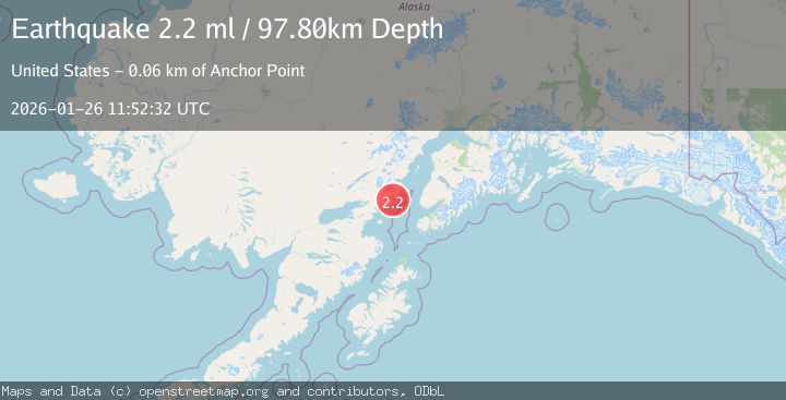
A 2.2 magnitude earthquake struck on 61 km W of Anchor Point, Alaska, at Mon, 26 Jan 2026 11:52:32 GMT. Depth: 97.8km. Reviewed by USGS seismologists, this minor quake occurred at a magnitude type of ml.
Magnitude
2.2
ml
Source
USGS
Intensity
-
Agency Reports
1 Sources| Source | Magnitude | Depth | Time |
|---|---|---|---|
| USGSPrimary | 2.2 | 98 km | 22 hours ago |
Earthquake Details
AutomaticEvent IDusgs_ak2026buuuap
Tsunami PotentialNo
Magnitude Typeml
Nearest Places
- Chinitna Bay3.8 km
- Gull Island4.4 km
- Sea Otter Point5.6 km
- Mount Chinitna5.8 km
- East Glacier Creek7.1 km
Comments
Join the discussion about this event.
Latest Earthquakes
1.3Mag
15 km W of Johannesburg, CA
Time23 hours ago
Depth7.83 km
SourceUSGS (Automatic)
0.7Mag
7 km W of Cobb, CA
Time23 hours ago
Depth0.94 km
SourceUSGS (Automatic)
1.7Mag
23 km SW of Snyder, Texas
Time23 hours ago
Depth2.60 km
SourceUSGS (Automatic)
2.9Mag
ICELAND REGION
Time23 hours ago
Depth10.20 km
SourceIMO (Automatic)
2.4Mag
Java, Indonesia
Time23 hours ago
Depth2.92 km
SourceBMKG (Automatic)
Nearby Earthquakes
2.6Mag
59 km W of Anchor Point, Alaska
Time1 day ago
Depth84.90 km
SourceUSGS (Automatic)
1.2Mag
53 km E of Pedro Bay, Alaska
Time4 days ago
Depth123.10 km
SourceUSGS (Automatic)
1.5Mag
53 km E of Pedro Bay, Alaska
Time4 days ago
Depth120.40 km
SourceUSGS (Automatic)
2.4Mag
51 km E of Pedro Bay, Alaska
Time2 days ago
Depth121.10 km
SourceUSGS (Automatic)
2.2Mag
52 km WNW of Anchor Point, Alaska
Time2 days ago
Depth101.30 km
SourceUSGS (Automatic)