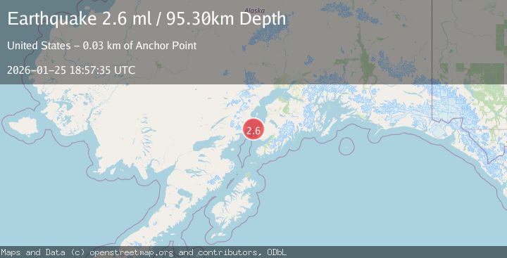
Earthquake 59 km W of Anchor Point, Alaska
Sun, 25 Jan 2026 18:35:31 GMT
Time1 day ago
Location
59.7760, -152.8820
Depth
84.9 KM
Event Summary
A 2.6 magnitude earthquake struck on 59 km W of Anchor Point, Alaska, at Sun, 25 Jan 2026 18:35:31 GMT. Depth: 84.9km. Reviewed by USGS seismologists, this minor quake occurred at a magnitude type of ml.
Magnitude
2.6
ml
Source
USGS
Intensity
-
Agency Reports
2 Sources| Source | Magnitude | Depth | Time |
|---|---|---|---|
| USGSPrimary | 2.6 | 88 km | 1 day ago |
| NEIC | 2.6 | 95 km | 1 day ago |
Earthquake Details
AutomaticEvent IDusgs_ak2026btmkka
Tsunami PotentialNo
Magnitude Typeml
Nearest Places
- Mount Chinitna8.1 km
- Chinitna Bay8.3 km
- Gull Island9.3 km
- South Chinitna Mountain9.4 km
- Sea Otter Point10.1 km
Comments
Join the discussion about this event.
Latest Earthquakes
2.4Mag
NEVADA
Time7 minutes ago
Depth16.00 km
SourceNN (Automatic)
3.1Mag
Northern Molucca Sea
Time9 minutes ago
Depth31.63 km
SourceBMKG (Automatic)
2.1Mag
SOUTHERN ITALY
Time13 minutes ago
Depth10.00 km
SourceINGV (Automatic)
2.6Mag
Northern Sumatra, Indonesia
Time14 minutes ago
Depth0.60 km
SourceBMKG (Automatic)
2.1Mag
SOUTHERN TEXAS
Time14 minutes ago
Depth0.00 km
SourceTX (Automatic)
Nearby Earthquakes
2.2Mag
61 km W of Anchor Point, Alaska
Time22 hours ago
Depth97.80 km
SourceUSGS (Automatic)
1.5Mag
53 km E of Pedro Bay, Alaska
Time4 days ago
Depth120.40 km
SourceUSGS (Automatic)
1.2Mag
53 km E of Pedro Bay, Alaska
Time4 days ago
Depth123.10 km
SourceUSGS (Automatic)
2.4Mag
51 km E of Pedro Bay, Alaska
Time2 days ago
Depth121.10 km
SourceUSGS (Automatic)
2.0Mag
66 km ESE of Pedro Bay, Alaska
Time4 days ago
Depth95.00 km
SourceUSGS (Automatic)