Earthquake 36 km WSW of Tonsina, Alaska
Tue, 27 Jan 2026 05:09:41 GMT
Time2 hours ago
Location
61.5350, -145.8190
Depth
41.6 KM
Event Summary
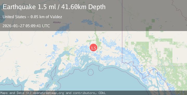
A 1.5 magnitude earthquake struck on 36 km WSW of Tonsina, Alaska, at Tue, 27 Jan 2026 05:09:41 GMT. Depth: 41.6km. Reviewed by USGS seismologists, this minor quake occurred at a magnitude type of ml.
Magnitude
1.5
ml
Source
USGS
Intensity
-
Agency Reports
1 Sources| Source | Magnitude | Depth | Time |
|---|---|---|---|
| USGSPrimary | 1.5 | 42 km | 2 hours ago |
Earthquake Details
AutomaticEvent IDusgs_ak2026bwddte
Tsunami PotentialNo
Magnitude Typeml
Nearest Places
- Bence Mountain6.6 km
- Black Mountain9.7 km
- Mayer Peak11.2 km
- Twin Lake Creek11.8 km
- Hallet River12.2 km
Comments
Join the discussion about this event.
Latest Earthquakes
1.9Mag
5 km ESE of Pearsall, Texas
Time7 minutes ago
Depth8.84 km
SourceUSGS (Automatic)
3.9Mag
Minahassa Peninsula, Sulawesi
Time12 minutes ago
Depth203.73 km
SourceBMKG (Automatic)
2.6Mag
SUMBAWA REGION, INDONESIA
Time13 minutes ago
Depth184.00 km
SourceBMKG (Automatic)
1.5Mag
6 km SW of Gilroy, CA
Time15 minutes ago
Depth2.74 km
SourceUSGS (Automatic)
4.1Mag
OFFSHORE GUATEMALA
Time18 minutes ago
Depth10.00 km
SourceINET (Automatic)
Nearby Earthquakes
1.8Mag
47 km SSE of Nelchina, Alaska
Time3 days ago
Depth18.10 km
SourceUSGS (Automatic)
1.5Mag
44 km N of Valdez, Alaska
Time3 days ago
Depth18.90 km
SourceUSGS (Automatic)
2.6Mag
22 km N of Valdez, Alaska
Time1 day ago
Depth25.10 km
SourceUSGS (Automatic)
1.9Mag
37 km NNW of Valdez, Alaska
Time2 days ago
Depth36.10 km
SourceUSGS (Automatic)
1.4Mag
40 km NNW of Valdez, Alaska
Time16 hours ago
Depth43.80 km
SourceUSGS (Automatic)