Earthquake 67 km WNW of Aleneva, Alaska
Thu, 29 Jan 2026 09:36:02 GMT
Time9 hours ago
Location
58.2460, -153.9930
Depth
71.7 KM
Event Summary
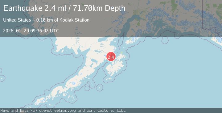
A 2.4 magnitude earthquake struck on 67 km WNW of Aleneva, Alaska, at Thu, 29 Jan 2026 09:36:02 GMT. Depth: 71.7km. Reviewed by USGS seismologists, this minor quake occurred at a magnitude type of ml.
Magnitude
2.4
ml
Source
USGS
Intensity
-
Agency Reports
1 Sources| Source | Magnitude | Depth | Time |
|---|---|---|---|
| USGSPrimary | 2.4 | 72 km | 9 hours ago |
Earthquake Details
AutomaticEvent IDusgs_ak2026cadlaz
Tsunami PotentialNo
Magnitude Typeml
Nearest Places
- Kaflia Bay7.3 km
- Cape Ugyak7.5 km
- Kulichkof Island7.7 km
- Cape Gull9.5 km
- Kaflia Bay10.8 km
Comments
Join the discussion about this event.
Latest Earthquakes
1.8Mag
EASTERN TURKEY
Time9 hours ago
Depth7.00 km
SourceAFAD (Automatic)
0.5Mag
SLOVENIA
Time9 hours ago
Depth2.00 km
SourceOGS (Automatic)
2.4Mag
10 km WSW of Pine Valley, CA
Time9 hours ago
Depth18.22 km
SourceUSGS (Automatic)
3.0Mag
PHILIPPINE ISLANDS REGION
Time9 hours ago
Depth2.00 km
SourcePIVS (Automatic)
2.2Mag
FRANCE
Time9 hours ago
Depth10.10 km
SourceReNaSS (Automatic)
Nearby Earthquakes
1.5Mag
61 km N of Karluk, Alaska
Time2 days ago
Depth83.80 km
SourceUSGS (Automatic)
1.5Mag
100 km N of Karluk, Alaska
Time5 days ago
Depth5.00 km
SourceUSGS (Automatic)
1.3Mag
60 km NNW of Karluk, Alaska
Time2 days ago
Depth5.00 km
SourceUSGS (Automatic)
1.1Mag
102 km S of Kokhanok, Alaska
Time1 week ago
Depth65.40 km
SourceUSGS (Automatic)
0.8Mag
80 km NNW of Karluk, Alaska
Time1 day ago
Depth5.00 km
SourceUSGS (Automatic)