Earthquake 17 km N of Fishhook, Alaska
Thu, 29 Jan 2026 10:12:07 GMT
Time4 hours ago
Location
61.9000, -149.3000
Depth
6.4 KM
Event Summary
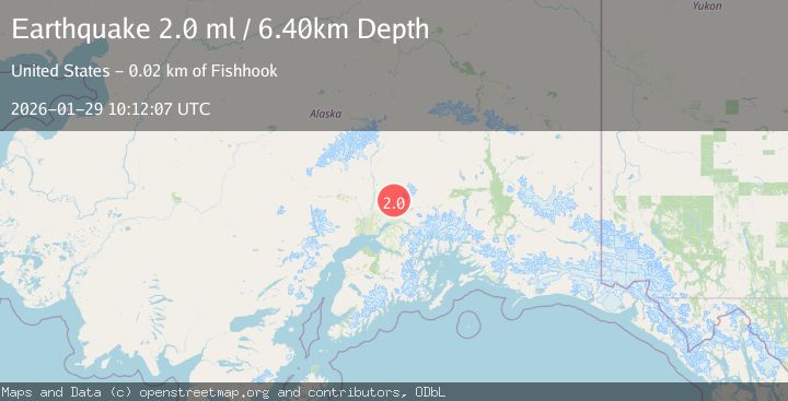
A 2.0 magnitude earthquake struck on 17 km N of Fishhook, Alaska, at Thu, 29 Jan 2026 10:12:07 GMT. Depth: 6.4km. Reviewed by USGS seismologists, this minor quake occurred at a magnitude type of ml.
Magnitude
2.0
ml
Source
USGS
Intensity
-
Agency Reports
1 Sources| Source | Magnitude | Depth | Time |
|---|---|---|---|
| USGSPrimary | 2.0 | 6 km | 4 hours ago |
Earthquake Details
AutomaticEvent IDusgs_ak2026caeqdj
Tsunami PotentialNo
Magnitude Typeml
Nearest Places
- Lane Prospect7.1 km
- Bartholf Creek8.7 km
- Talkeetna Mine8.8 km
- Fern Mine8.9 km
- Independence Mine Dam9.1 km
Comments
Join the discussion about this event.
Latest Earthquakes
2.4Mag
Minahassa Peninsula, Sulawesi
Time4 minutes ago
Depth41.66 km
SourceBMKG (Automatic)
1.1Mag
5 km W of Cobb, CA
Time7 minutes ago
Depth1.84 km
SourceUSGS (Automatic)
2.3Mag
Sumbawa Region, Indonesia
Time8 minutes ago
Depth24.84 km
SourceBMKG (Automatic)
1.6Mag
7 km NNE of Coso Junction, CA
Time14 minutes ago
Depth3.84 km
SourceUSGS (Automatic)
1.8Mag
22 km SSE of Eureka Roadhouse, Alaska
Time19 minutes ago
Depth35.50 km
SourceUSGS (Automatic)
Nearby Earthquakes
2.1Mag
10 km NW of Sutton-Alpine, Alaska
Time1 day ago
Depth0.10 km
SourceUSGS (Automatic)
1.8Mag
36 km NNW of Sutton-Alpine, Alaska
Time4 days ago
Depth37.60 km
SourceUSGS (Automatic)
2.0Mag
13 km ENE of Willow, Alaska
Time2 days ago
Depth26.90 km
SourceUSGS (Automatic)
1.5Mag
14 km E of Susitna North, Alaska
Time6 days ago
Depth29.40 km
SourceUSGS (Automatic)
1.7Mag
1 km NE of Gateway, Alaska
Time5 days ago
Depth23.40 km
SourceUSGS (Automatic)