Earthquake 82 km NW of Karluk, Alaska
Thu, 29 Jan 2026 20:26:44 GMT
Time5 hours ago
Location
58.0490, -155.5200
Depth
5.0 KM
Event Summary
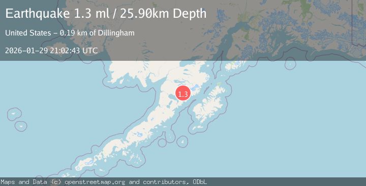
A 1.3 magnitude earthquake struck on 82 km NW of Karluk, Alaska, at Thu, 29 Jan 2026 20:26:44 GMT. Depth: 5km. Reviewed by USGS seismologists, this minor quake occurred at a magnitude type of ml.
Magnitude
1.3
ml
Source
USGS
Intensity
-
Agency Reports
1 Sources| Source | Magnitude | Depth | Time |
|---|---|---|---|
| USGSPrimary | 1.3 | 26 km | 5 hours ago |
Earthquake Details
AutomaticEvent IDusgs_ak2026cayztq
Tsunami PotentialNo
Magnitude Typeml
Nearest Places
- Kejulik Pass3.2 km
- Kejulik Mountains4.0 km
- Gas Creek8.1 km
- Albert Creek16.6 km
- East Fork Kejulik River16.6 km
Comments
Join the discussion about this event.
Latest Earthquakes
2.6Mag
51 km E of Pedro Bay, Alaska
Time11 minutes ago
Depth114.80 km
SourceUSGS (Automatic)
2.7Mag
WESTERN TURKEY
Time14 minutes ago
Depth6.30 km
SourceKOERI (Automatic)
1.9Mag
70 km ENE of Chase, Alaska
Time22 minutes ago
Depth0.90 km
SourceUSGS (Automatic)
1.3Mag
TURKEY-SYRIA-IRAQ BORDER REGION
Time24 minutes ago
Depth9.40 km
SourceAFAD (Automatic)
2.3Mag
WESTERN TURKEY
Time25 minutes ago
Depth11.70 km
SourceKOERI (Automatic)
Nearby Earthquakes
0.4Mag
77 km NW of Karluk, Alaska
Time6 days ago
Depth8.80 km
SourceUSGS (Automatic)
1.4Mag
73 km NW of Karluk, Alaska
Time1 week ago
Depth1.20 km
SourceUSGS (Automatic)
1.0Mag
85 km NW of Karluk, Alaska
Time4 days ago
Depth5.00 km
SourceUSGS (Automatic)
0.4Mag
86 km NW of Karluk, Alaska
Time6 days ago
Depth5.00 km
SourceUSGS (Automatic)
0.6Mag
88 km NW of Karluk, Alaska
Time1 day ago
Depth5.00 km
SourceUSGS (Automatic)