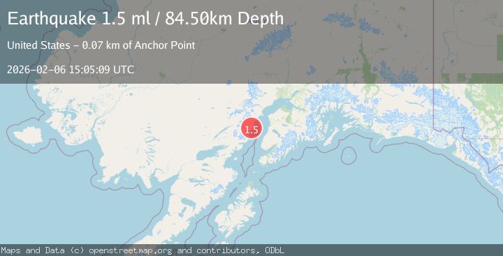
Earthquake 52 km NW of Ninilchik, Alaska
Fri, 06 Feb 2026 15:05:09 GMT
Time1 hour ago
Location
60.3300, -152.4280
Depth
84.5 KM
Event Summary
A 1.5 magnitude earthquake struck on 52 km NW of Ninilchik, Alaska, at Fri, 06 Feb 2026 15:05:09 GMT. Depth: 84.5km. Reviewed by USGS seismologists, this minor quake occurred at a magnitude type of ml.
Magnitude
1.5
ml
Source
USGS
Intensity
-
Agency Reports
1 Sources| Source | Magnitude | Depth | Time |
|---|---|---|---|
| USGSPrimary | 1.5 | 85 km | 1 hour ago |
Earthquake Details
AutomaticEvent IDusgs_ak2026cpgdrf
Tsunami PotentialNo
Magnitude Typeml
Nearest Places
- Redoubt area2.2 km
- Redoubt Point4.8 km
- Little Polly Creek5.3 km
- Polly Creek5.7 km
- Redoubt Creek7.5 km
Comments
Join the discussion about this event.
Latest Earthquakes
2.5Mag
South of Sumbawa, Indonesia
Time8 minutes ago
Depth10.00 km
SourceBMKG (Automatic)
2.5Mag
Savu Sea
Time11 minutes ago
Depth31.49 km
SourceBMKG (Automatic)
2.4Mag
Banda Sea
Time14 minutes ago
Depth5.00 km
SourceBMKG (Automatic)
5.0Mag
EAST OF KURIL ISLANDS
Time14 minutes ago
Depth12.00 km
SourceEMSC (Automatic)
2.7Mag
Talaud Islands, Indonesia
Time15 minutes ago
Depth19.84 km
SourceBMKG (Automatic)
Nearby Earthquakes
2.3Mag
53 km WNW of Ninilchik, Alaska
Time1 week ago
Depth109.70 km
SourceUSGS (Automatic)
2.1Mag
60 km WNW of Ninilchik, Alaska
Time2 weeks ago
Depth109.40 km
SourceUSGS (Automatic)
2.9Mag
69 km WNW of Ninilchik, Alaska
Time5 days ago
Depth125.80 km
SourceUSGS (Automatic)
1.9Mag
Southern Alaska
Time2 weeks ago
Depth82.60 km
SourceUSGS (Automatic)
2.7Mag
52 km WNW of Happy Valley, Alaska
Time7 hours ago
Depth93.60 km
SourceUSGS (Automatic)