Earthquake 55 km N of Petersville, Alaska
Fri, 13 Feb 2026 11:26:11 GMT
Time5 days ago
Location
62.9870, -150.5990
Depth
122.8 KM
Event Summary
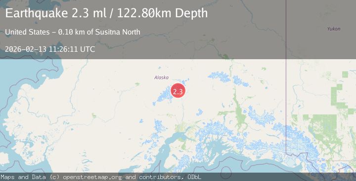
A 2.3 magnitude earthquake struck on 55 km N of Petersville, Alaska, at Fri, 13 Feb 2026 11:26:11 GMT. Depth: 122.8km. Reviewed by USGS seismologists, this minor quake occurred at a magnitude type of ml.
Magnitude
2.3
ml
Source
USGS
Intensity
-
Agency Reports
1 Sources| Source | Magnitude | Depth | Time |
|---|---|---|---|
| USGSPrimary | 2.3 | 123 km | 5 days ago |
Earthquake Details
AutomaticEvent IDusgs_ak2026dbuzef
Tsunami PotentialNo
Magnitude Typeml
Nearest Places
- Mooses Tooth2.0 km
- Don Sheldon Amphitheater5.3 km
- The Gateway5.6 km
- Explorers Peak6.3 km
- Mount Barrille6.4 km
Comments
Join the discussion about this event.
Latest Earthquakes
2.5Mag
Bering Strait
Time8 minutes ago
Depth200.07 km
SourceVYT (Automatic)
2.3Mag
Sumbawa Region, Indonesia
Time8 minutes ago
Depth10.00 km
SourceBMKG
1.6Mag
13 km ENE of Falls City, Texas
Time18 minutes ago
Depth7.18 km
SourceUSGS (Automatic)
1.5Mag
EASTERN TURKEY
Time21 minutes ago
Depth7.00 km
SourceAFAD (Automatic)
1.3Mag
5 km S of Cabazon, CA
Time21 minutes ago
Depth5.80 km
SourceUSGS (Automatic)
Nearby Earthquakes
3.2Mag
Central Alaska
Time6 days ago
Depth110.11 km
SourceVYT (Automatic)
1.7Mag
57 km N of Petersville, Alaska
Time1 week ago
Depth99.30 km
SourceUSGS (Automatic)
3.0Mag
CENTRAL ALASKA
Time3 years ago
Depth106.00 km
SourceNEIC (Automatic)
5.0Mag
CENTRAL ALASKA
Time7 years ago
Depth115.00 km
SourceEMSC (Automatic)
3.0Mag
CENTRAL ALASKA
Time3 years ago
Depth102.00 km
SourceNEIC (Automatic)