Earthquake 152 km SE of Nikolski, Alaska
Mon, 16 Feb 2026 00:15:25 GMT
Time3 days ago
Location
52.1220, -167.0620
Depth
96.2 KM
Event Summary
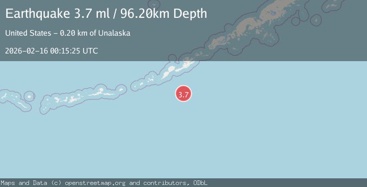
A 3.7 magnitude earthquake struck on 152 km SE of Nikolski, Alaska, at Mon, 16 Feb 2026 00:15:25 GMT. Depth: 96.2km. Reviewed by USGS seismologists, this minor quake occurred at a magnitude type of ml.
Magnitude
3.7
ml
Source
USGS
Intensity
-
Agency Reports
1 Sources| Source | Magnitude | Depth | Time |
|---|---|---|---|
| USGSPrimary | 3.7 | 96 km | 3 days ago |
Earthquake Details
AutomaticEvent IDusgs_ak2026dglxpx
Tsunami PotentialNo
Magnitude Typeml
Nearest Places
- Umnak Basin73.3 km
- Unalaska Basin103.2 km
- Usof Canyon110.2 km
- South Rock128.5 km
- Cape Aiak129.6 km
Comments
Join the discussion about this event.
Latest Earthquakes
2.8Mag
Flores Sea
Time17 hours ago
Depth187.74 km
SourceVYT (Automatic)
1.4Mag
7 km ESE of Wrightwood, CA
Time17 hours ago
Depth11.86 km
SourceUSGS (Automatic)
1.4Mag
Tarapaca, Chile
Time17 hours ago
Depth13.06 km
SourceVYT (Automatic)
1.2Mag
47 km ESE of McCarthy, Alaska
Time17 hours ago
Depth4.30 km
SourceUSGS (Automatic)
2.1Mag
WESTERN TEXAS
Time17 hours ago
Depth2.20 km
SourceTX (Automatic)
Nearby Earthquakes
3.0Mag
FOX ISLANDS, ALEUTIAN ISLANDS
Time2 years ago
Depth28.00 km
SourceNEIR (Automatic)
5.2Mag
FOX ISLANDS, ALEUTIAN ISLANDS
Time4 years ago
Depth10.00 km
SourceEMSC (Automatic)
3.1Mag
FOX ISLANDS, ALEUTIAN ISLANDS
Time1 month ago
Depth35.00 km
SourceNEIC (Automatic)
4.0Mag
FOX ISLANDS, ALEUTIAN ISLANDS
Time6 years ago
Depth10.00 km
SourceNEIC (Automatic)
2.9Mag
FOX ISLANDS, ALEUTIAN ISLANDS
Time2 months ago
Depth35.00 km
SourceNEIC (Automatic)