Earthquake 79 km WNW of Nikiski, Alaska
Fri, 27 Feb 2026 13:23:22 GMT
Time1 hour ago
Location
60.9670, -152.6410
Depth
149.1 KM
Event Summary
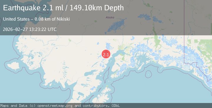
A 2.1 magnitude earthquake struck on 79 km WNW of Nikiski, Alaska, at Fri, 27 Feb 2026 13:23:22 GMT. Depth: 149.1km. Reviewed by USGS seismologists, this minor quake occurred at a magnitude type of ml.
Magnitude
2.1
ml
Source
USGS
Intensity
-
Agency Reports
1 Sources| Source | Magnitude | Depth | Time |
|---|---|---|---|
| USGSPrimary | 2.1 | 149 km | 1 hour ago |
Earthquake Details
AutomaticEvent IDusgs_aka2026ebramw
Tsunami PotentialNo
Magnitude Typeml
Nearest Places
- 9.9 km
- 14.8 km
- 17.2 km
- 17.2 km
- 17.8 km
Comments
Join the discussion about this event.
Latest Earthquakes
3.3Mag
Northern Molucca Sea
Time1 hour ago
Depth10.00 km
SourceBMKG
1.8Mag
18 km SE of Pāhala, Hawaii
Time1 hour ago
Depth41.61 km
SourceUSGS (Automatic)
1.6Mag
Southern California
Time1 hour ago
Depth10.50 km
SourceVYT (Automatic)
2.0Mag
WESTERN TEXAS
Time1 hour ago
Depth4.20 km
SourceTX (Automatic)
3.5Mag
CENTRAL PERU
Time1 hour ago
Depth20.00 km
SourceLIM (Automatic)
Nearby Earthquakes
2.4Mag
SOUTHERN ALASKA
Time1 month ago
Depth150.40 km
SourceNEIC (Automatic)
0.8Mag
71 km WNW of Nikiski, Alaska
Time2 weeks ago
Depth16.60 km
SourceUSGS (Automatic)
1.4Mag
70 km WNW of Nikiski, Alaska
Time2 weeks ago
Depth129.20 km
SourceUSGS (Automatic)
0.8Mag
Southern Alaska
Time2 weeks ago
Depth19.65 km
SourceVYT (Automatic)
2.1Mag
Southern Alaska
Time3 days ago
Depth126.83 km
SourceVYT (Automatic)