Earthquake 92 km NNW of Yakutat, Alaska
Sat, 28 Feb 2026 14:04:19 GMT
Time4 hours ago
Location
60.3460, -140.1660
Depth
0.4 KM
Event Summary
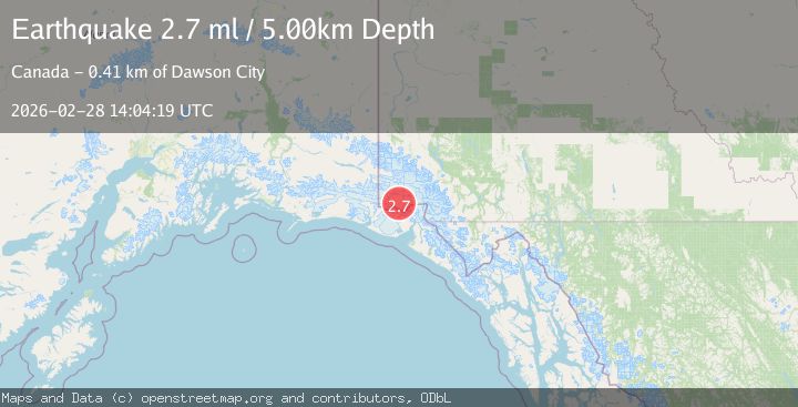
A 2.7 magnitude earthquake struck on 92 km NNW of Yakutat, Alaska, at Sat, 28 Feb 2026 14:04:19 GMT. Depth: 0.4km. Reviewed by USGS seismologists, this minor quake occurred at a magnitude type of ml.
Magnitude
2.7
ml
Source
USGS
Intensity
-
Agency Reports
1 Sources| Source | Magnitude | Depth | Time |
|---|---|---|---|
| USGSPrimary | 2.7 | 0 km | 4 hours ago |
Earthquake Details
AutomaticEvent IDusgs_aka2026edocqi
Tsunami PotentialNo
Magnitude Typeml
Nearest Places
- 8.9 km
- 11.7 km
- 12.9 km
- 14.6 km
- 14.9 km
Comments
Join the discussion about this event.
Latest Earthquakes
3.6Mag
Southern Yukon Territory, Canada
Time4 hours ago
Depth10.00 km
SourceVYT (Automatic)
1.6Mag
Central Alaska
Time4 hours ago
Depth0.00 km
SourceVYT (Automatic)
2.3Mag
Near North Coast of West Papua
Time4 hours ago
Depth10.00 km
SourceBMKG
2.7Mag
near the coast of Antofagasta, Chile
Time4 hours ago
Depth0.00 km
SourceVYT (Automatic)
1.9Mag
Southern Alaska
Time4 hours ago
Depth10.00 km
SourceVYT (Automatic)
Nearby Earthquakes
2.5Mag
88 km NNW of Yakutat, Alaska
Time1 month ago
Depth36.90 km
SourceUSGS (Automatic)
2.3Mag
Southeastern Alaska
Time1 day ago
Depth0.61 km
SourceVYT (Automatic)
2.1Mag
Southeastern Alaska
Time1 week ago
Depth0.00 km
SourceVYT (Automatic)
1.9Mag
Southeastern Alaska
Time1 week ago
Depth0.00 km
SourceVYT (Automatic)
1.6Mag
Southeastern Alaska
Time1 day ago
Depth13.79 km
SourceVYT (Automatic)