Earthquake 88 km NNW of Yakutat, Alaska
Sat, 24 Jan 2026 02:28:42 GMT
Time3 days ago
Location
60.3130, -140.1140
Depth
36.9 KM
Event Summary
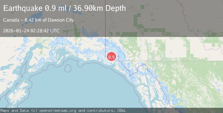
A 0.9 magnitude earthquake struck on 88 km NNW of Yakutat, Alaska, at Sat, 24 Jan 2026 02:28:42 GMT. Depth: 36.9km. Reviewed by USGS seismologists, this minor quake occurred at a magnitude type of ml.
Magnitude
0.9
ml
Source
USGS
Intensity
-
Agency Reports
1 Sources| Source | Magnitude | Depth | Time |
|---|---|---|---|
| USGSPrimary | 0.9 | 37 km | 3 days ago |
Earthquake Details
AutomaticEvent IDusgs_ak2026bqkqjx
Tsunami PotentialNo
Magnitude Typeml
Nearest Places
- Corwin Cliffs9.8 km
- Seward Glacier11.7 km
- Mount Owen12.7 km
- Mount Eaton14.4 km
- Mount Cook16.3 km
Comments
Join the discussion about this event.
Latest Earthquakes
2.6Mag
Minahassa Peninsula, Sulawesi
Time3 minutes ago
Depth10.00 km
SourceBMKG (Automatic)
1.1Mag
30 km NE of Los Alamos, CA
Time13 minutes ago
Depth4.17 km
SourceUSGS (Automatic)
1.2Mag
EASTERN TURKEY
Time13 minutes ago
Depth7.00 km
SourceAFAD (Automatic)
2.6Mag
Timor Region
Time16 minutes ago
Depth35.26 km
SourceBMKG (Automatic)
2.3Mag
Sumbawa Region, Indonesia
Time16 minutes ago
Depth10.00 km
SourceBMKG (Automatic)
Nearby Earthquakes
1.8Mag
110 km N of Yakutat, Alaska
Time10 hours ago
Depth9.50 km
SourceUSGS
4.4Mag
SOUTHERN YUKON TERRITORY, CANADA
Time2 days ago
Depth5.00 km
SourceAK (Automatic)
1.6Mag
102 km NW of Yakutat, Alaska
Time1 day ago
Depth15.10 km
SourceUSGS (Automatic)
2.5Mag
SOUTHERN YUKON TERRITORY, CANADA
Time15 hours ago
Depth5.90 km
SourceNEIC (Automatic)
2.5Mag
134 km N of Yakutat, Alaska
Time1 week ago
Depth8.60 km
SourceUSGS