Earthquake 119 km WNW of Yakutat, Alaska
Tue, 03 Mar 2026 10:35:03 GMT
Time1 hour ago
Location
60.1290, -141.5220
Depth
21.8 KM
Event Summary
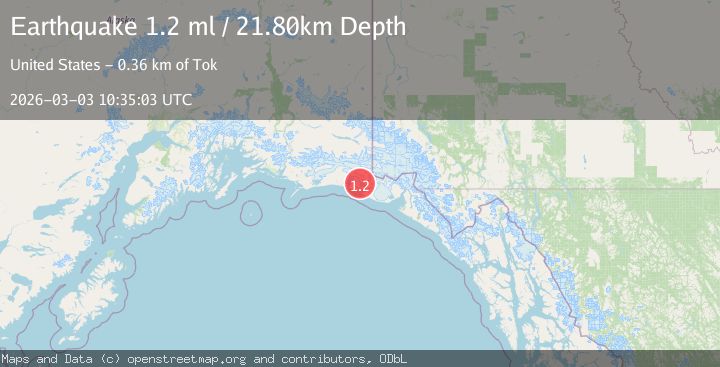
A 1.2 magnitude earthquake struck on 119 km WNW of Yakutat, Alaska, at Tue, 03 Mar 2026 10:35:03 GMT. Depth: 21.8km. Reviewed by USGS seismologists, this minor quake occurred at a magnitude type of ml.
Magnitude
1.2
ml
Source
USGS
Intensity
-
Agency Reports
1 Sources| Source | Magnitude | Depth | Time |
|---|---|---|---|
| USGSPrimary | 1.2 | 22 km | 1 hour ago |
Earthquake Details
AutomaticEvent IDusgs_aka2026eiuiws
Tsunami PotentialNo
Magnitude Typeml
Nearest Places
- 7.3 km
- 9.2 km
- 12.3 km
- 13.1 km
- 13.9 km
Comments
Join the discussion about this event.
Latest Earthquakes
0.7Mag
2 km NNE of The Geysers, CA
Time7 minutes ago
Depth2.45 km
SourceUSGS (Automatic)
1.7Mag
Region Metropolitana, Chile
Time9 minutes ago
Depth41.26 km
SourceVYT (Automatic)
0.9Mag
Central Alaska
Time9 minutes ago
Depth12.94 km
SourceVYT (Automatic)
1.0Mag
18 km SSW of Ocotillo Wells, CA
Time9 minutes ago
Depth11.32 km
SourceUSGS (Automatic)
1.1Mag
19 km NNE of Indio, CA
Time12 minutes ago
Depth4.68 km
SourceUSGS (Automatic)
Nearby Earthquakes
1.8Mag
Southeastern Alaska
Time1 week ago
Depth0.00 km
SourceVYT (Automatic)
1.3Mag
Southeastern Alaska
Time1 week ago
Depth21.48 km
SourceVYT (Automatic)
2.8Mag
Southeastern Alaska
Time2 weeks ago
Depth0.00 km
SourceVYT (Automatic)
1.2Mag
Southeastern Alaska
Time2 weeks ago
Depth0.85 km
SourceVYT (Automatic)
2.1Mag
107 km NW of Yakutat, Alaska
Time3 weeks ago
Depth12.00 km
SourceUSGS (Automatic)