Earthquake 110 km N of Yakutat, Alaska
Thu, 05 Mar 2026 23:01:35 GMT
Time1 hour ago
Location
60.5370, -139.7770
Depth
6.4 KM
Event Summary
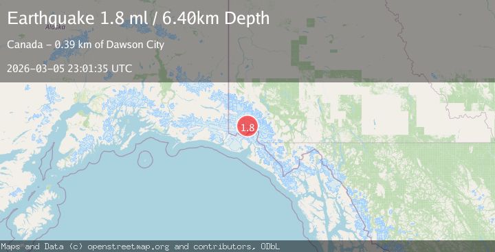
A 1.8 magnitude earthquake struck on 110 km N of Yakutat, Alaska, at Thu, 05 Mar 2026 23:01:35 GMT. Depth: 6.4km. Reviewed by USGS seismologists, this minor quake occurred at a magnitude type of ml.
Magnitude
1.8
ml
Source
USGS
Intensity
-
Agency Reports
1 Sources| Source | Magnitude | Depth | Time |
|---|---|---|---|
| USGSPrimary | 1.8 | 6 km | 1 hour ago |
Earthquake Details
ConfirmedEvent IDusgs_aka2026enknzn
Tsunami PotentialNo
Magnitude Typeml
Nearest Places
- 0.9 km
- 10.6 km
- 11.8 km
- 16.8 km
- 20.3 km
Comments
Join the discussion about this event.
Latest Earthquakes
2.7Mag
Antofagasta, Chile
Time1 hour ago
Depth129.52 km
SourceVYT (Automatic)
2.2Mag
Southeastern Alaska
Time1 hour ago
Depth11.11 km
SourceVYT (Automatic)
1.6Mag
31 km NNW of Beluga, Alaska
Time1 hour ago
Depth73.40 km
SourceUSGS (Automatic)
1.8Mag
12 km N of Toyah, Texas
Time1 hour ago
Depth6.84 km
SourceUSGS (Automatic)
1.1Mag
10 km N of Aguanga, CA
Time1 hour ago
Depth8.63 km
SourceUSGS (Automatic)
Nearby Earthquakes
3.0Mag
SOUTHERN YUKON TERRITORY, CANADA
Time2 months ago
Depth1.10 km
SourceAK (Automatic)
4.0Mag
SOUTHERN YUKON TERRITORY, CANADA
Time2 months ago
Depth3.70 km
SourceAK (Automatic)
2.2Mag
Southeastern Alaska
Time2 weeks ago
Depth0.00 km
SourceVYT (Automatic)
2.0Mag
Southeastern Alaska
Time3 weeks ago
Depth27.71 km
SourceVYT (Automatic)
3.0Mag
SOUTHERN YUKON TERRITORY, CANADA
Time2 months ago
Depth5.00 km
SourceAK (Automatic)