Earthquake 7 km SSE of Banning, CA
Fri, 09 Jan 2026 08:10:38 GMT
Time2 days ago
Location
33.8695, -116.8508
Depth
15.3 KM
Event Summary
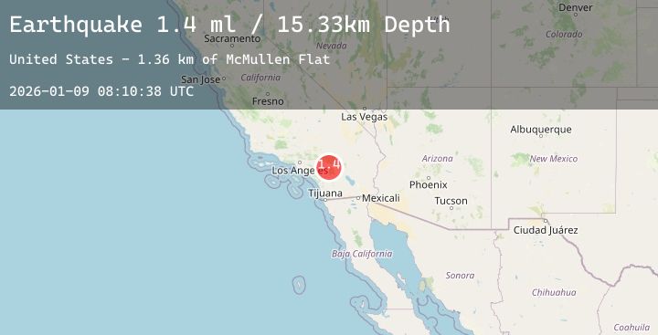
A 1.4 magnitude earthquake struck on 7 km SSE of Banning, CA, at Fri, 09 Jan 2026 08:10:38 GMT. Depth: 15.3299999237061km. Reviewed by USGS seismologists, this minor quake occurred at a magnitude type of ml.
Magnitude
1.4
ml
Source
USGS
Intensity
-
Agency Reports
4 Sources| Source | Magnitude | Depth | Time |
|---|---|---|---|
| USGSPrimary | 1.0 | 15 km | 2 days ago |
| USGSPrimary | 1.4 | 14 km | 2 days ago |
| USGSPrimary | 1.1 | 11 km | 2 days ago |
| USGSPrimary | 1.0 | 14 km | 2 days ago |
Earthquake Details
AutomaticEvent IDusgs_ci41154743
Tsunami PotentialNo
Magnitude Typeml
Nearest Places
- McMullen Flat1.4 km
- Chappel Ranch1.9 km
- Barker Peak2.1 km
- Barker Peak Lookout2.1 km
- Mount Oak Boys Ranch2.1 km
Comments
Join the discussion about this event.
Latest Earthquakes
0.8Mag
1 km SSW of Cobb, CA
Time2 days ago
Depth3.73 km
SourceUSGS (Automatic)
2.1Mag
FRANCE
Time2 days ago
Depth5.00 km
SourceReNaSS (Automatic)
3.0Mag
SALTA, ARGENTINA
Time2 days ago
Depth234.90 km
SourceCSN (Automatic)
2.6Mag
AEGEAN SEA
Time2 days ago
Depth15.20 km
SourceNOA (Automatic)
4.6Mag
58 km SE of Adak, Alaska
Time2 days ago
Depth40.00 km
SourceUSGS
Nearby Earthquakes
0.6Mag
23 km N of Borrego Springs, CA
Time2 days ago
Depth9.66 km
SourceUSGS (Automatic)
1.2Mag
3 km ESE of Lake Henshaw, CA
Time2 days ago
Depth11.47 km
SourceUSGS (Automatic)
0.7Mag
11 km N of Borrego Springs, CA
Time2 days ago
Depth12.27 km
SourceUSGS (Automatic)
0.9Mag
5 km W of Borrego Springs, CA
Time2 days ago
Depth4.53 km
SourceUSGS (Automatic)
1.6Mag
12 km WSW of Lytle Creek, CA
Time2 days ago
Depth4.76 km
SourceUSGS (Automatic)