Earthquake 11 km SW of Anza, CA
Thu, 15 Jan 2026 09:59:07 GMT
Time4 hours ago
Location
33.4937, -116.7632
Depth
8.7 KM
Event Summary
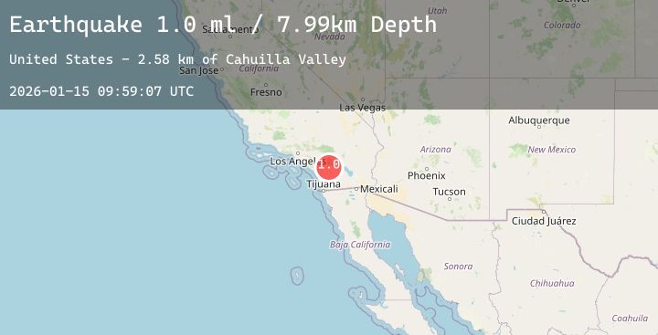
A 1.4 magnitude earthquake struck on 11 km SW of Anza, CA, at Thu, 15 Jan 2026 09:59:07 GMT. Depth: 8.71km. Reviewed by USGS seismologists, this minor quake occurred at a magnitude type of ml.
Magnitude
1.4
ml
Source
USGS
Intensity
-
Agency Reports
5 Sources| Source | Magnitude | Depth | Time |
|---|---|---|---|
| USGSPrimary | 0.9 | 9 km | 4 hours ago |
| USGSPrimary | 1.3 | 13 km | 4 hours ago |
| USGSPrimary | 1.1 | 14 km | 4 hours ago |
| USGSPrimary | 0.4 | 14 km | 4 hours ago |
| USGSPrimary | 1.4 | 17 km | 3 hours ago |
Earthquake Details
AutomaticEvent IDusgs_ci41158311
Tsunami PotentialNo
Magnitude Typeml
Nearest Places
- Cahuilla Valley2.7 km
- Elder Canyon3.2 km
- Million Dollar Canyon3.9 km
- Elder Creek4.0 km
- Riverside County Fire Department Station 77 - Lake Riverside4.1 km
Comments
Join the discussion about this event.
Latest Earthquakes
2.3Mag
Near North Coast of West Papua
Time7 minutes ago
Depth10.00 km
SourceBMKG (Automatic)
2.1Mag
Sumba Region, Indonesia
Time8 minutes ago
Depth47.56 km
SourceBMKG (Automatic)
1.3Mag
2 km SE of Pacifica, CA
Time9 minutes ago
Depth9.77 km
SourceUSGS (Automatic)
2.5Mag
47 km E of Denali National Park, Alaska
Time12 minutes ago
Depth2.80 km
SourceUSGS (Automatic)
2.0Mag
100 km N of Karluk, Alaska
Time16 minutes ago
Depth5.50 km
SourceUSGS (Automatic)
Nearby Earthquakes
0.7Mag
10 km S of Idyllwild, CA
Time54 minutes ago
Depth13.88 km
SourceUSGS (Automatic)
1.3Mag
7 km S of Palomar Observatory, CA
Time2 hours ago
Depth-0.60 km
SourceUSGS (Automatic)
1.2Mag
8 km SSE of Palomar Observatory, CA
Time2 hours ago
Depth13.90 km
SourceUSGS (Automatic)
3.5Mag
12 km ENE of Borrego Springs, CA
Time6 hours ago
Depth4.71 km
SourceUSGS (Automatic)
0.7Mag
9 km ENE of Villa Park, CA
Time10 hours ago
Depth7.47 km
SourceUSGS (Automatic)