Earthquake 9 km ENE of Heber, CA
Fri, 16 Jan 2026 01:17:49 GMT
Time1 hour ago
Location
32.7472, -115.4377
Depth
13.3 KM
Event Summary
A 1.5 magnitude earthquake struck on 9 km ENE of Heber, CA, at Fri, 16 Jan 2026 01:17:49 GMT. Depth: 13.28km. Reviewed by USGS seismologists, this minor quake occurred at a magnitude type of ml.
Magnitude
1.5
ml
Source
USGS
Intensity
-
Agency Reports
3 Sources| Source | Magnitude | Depth | Time |
|---|---|---|---|
| USGSPrimary | 1.5 | 13 km | 1 hour ago |
| USGSPrimary | 1.2 | 9 km | 56 minutes ago |
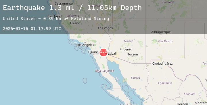
| USGSPrimary | 1.3 | 10 km | 37 minutes ago |
Earthquake Details
AutomaticEvent IDusgs_ci41159415
Tsunami PotentialNo
Magnitude Typeml
Nearest Places
- Ash Lateral Fifteen0.6 km
- South Central Drain1.1 km
- Lateral Nine1.3 km
- Ash Fifteen Drain1.5 km
- South Central Drain Two1.8 km
Comments
Join the discussion about this event.
Latest Earthquakes
2.1Mag
Northern Sumatra, Indonesia
Time3 minutes ago
Depth19.92 km
SourceBMKG (Automatic)
2.6Mag
11 km WSW of Stanton, Texas
Time5 minutes ago
Depth3.73 km
SourceUSGS (Automatic)
2.2Mag
CENTRAL TURKEY
Time20 minutes ago
Depth7.50 km
SourceKOERI (Automatic)
3.4Mag
CENTRAL CALIFORNIA
Time24 minutes ago
Depth10.00 km
SourceNEIC (Automatic)
3.4Mag
Northern Molucca Sea
Time28 minutes ago
Depth9.72 km
SourceBMKG (Automatic)
Nearby Earthquakes
1.9Mag
7 km SW of Holtville, CA
Time5 hours ago
Depth14.11 km
SourceUSGS (Automatic)
1.5Mag
11 km NNE of Ocotillo Wells, CA
Time6 hours ago
Depth9.83 km
SourceUSGS (Automatic)
2.3Mag
SOUTHERN CALIFORNIA
Time8 hours ago
Depth12.80 km
SourceSCSN (Automatic)
1.4Mag
7 km WSW of Holtville, CA
Time9 hours ago
Depth10.65 km
SourceUSGS (Automatic)
1.8Mag
8 km WSW of Holtville, CA
Time11 hours ago
Depth8.32 km
SourceUSGS (Automatic)