Earthquake 21 km ESE of Anza, CA
Fri, 16 Jan 2026 08:44:57 GMT
Time1 hour ago
Location
33.5073, -116.4560
Depth
4.4 KM
Event Summary
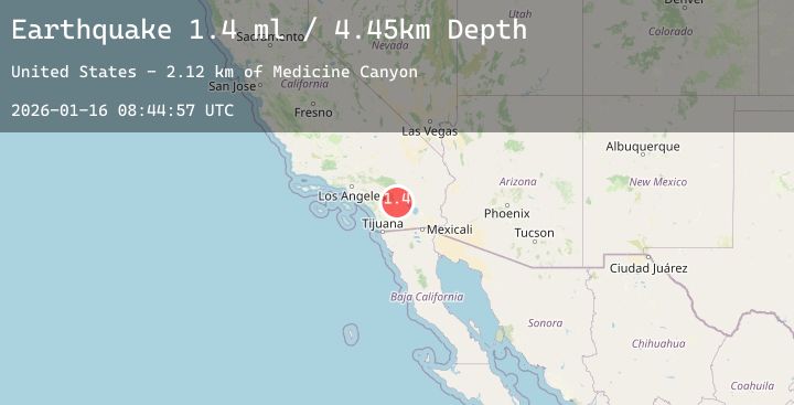
A 1.4 magnitude earthquake struck on 21 km ESE of Anza, CA, at Fri, 16 Jan 2026 08:44:57 GMT. Depth: 4.44999980926514km. Reviewed by USGS seismologists, this minor quake occurred at a magnitude type of ml.
Magnitude
1.4
ml
Source
USGS
Intensity
-
Agency Reports
3 Sources| Source | Magnitude | Depth | Time |
|---|---|---|---|
| USGSPrimary | 1.4 | 4 km | 1 hour ago |
| USGSPrimary | 0.3 | 15 km | 1 hour ago |
| USGSPrimary | 0.3 | 4 km | 1 hour ago |
Earthquake Details
AutomaticEvent IDusgs_ci41159543
Tsunami PotentialNo
Magnitude Typeml
Nearest Places
- Toro Spring1.4 km
- Toro Peak3.3 km
- Santa Rosa Mountain3.4 km
- Virgin Spring3.4 km
- Cedar Spring3.5 km
Comments
Join the discussion about this event.
Latest Earthquakes
3.7Mag
ALBANIA
Time3 minutes ago
Depth5.00 km
SourceTHE (Automatic)
1.6Mag
50 km WNW of Petersville, Alaska
Time10 minutes ago
Depth0.30 km
SourceUSGS (Automatic)
4.0Mag
CENTRAL TURKEY
Time12 minutes ago
Depth7.00 km
SourceAFAD (Automatic)
4.2Mag
Halmahera, Indonesia
Time22 minutes ago
Depth37.06 km
SourceBMKG (Automatic)
2.5Mag
14 km W of Petrolia, CA
Time25 minutes ago
Depth10.62 km
SourceUSGS (Automatic)
Nearby Earthquakes
2.1Mag
SOUTHERN CALIFORNIA
Time3 hours ago
Depth9.50 km
SourceSCSN (Automatic)
0.7Mag
9 km NNW of Idyllwild, CA
Time5 hours ago
Depth9.94 km
SourceUSGS (Automatic)
3.4Mag
7 km WSW of Morongo Valley, CA
Time7 hours ago
Depth7.75 km
SourceUSGS (Automatic)
1.2Mag
26 km WSW of Westmorland, CA
Time7 hours ago
Depth9.33 km
SourceUSGS (Automatic)
1.5Mag
11 km NNE of Ocotillo Wells, CA
Time14 hours ago
Depth9.83 km
SourceUSGS (Automatic)