Earthquake 8 km NNE of Banning, CA
Sun, 25 Jan 2026 07:14:56 GMT
Time2 days ago
Location
33.9992, -116.8552
Depth
12.6 KM
Event Summary
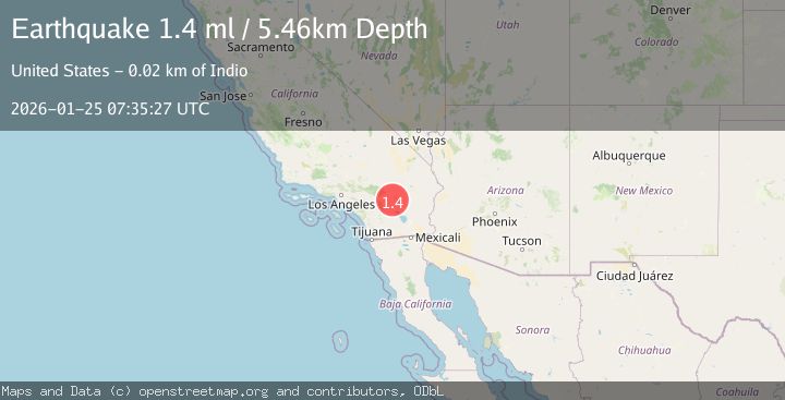
A 1.4 magnitude earthquake struck on 8 km NNE of Banning, CA, at Sun, 25 Jan 2026 07:14:56 GMT. Depth: 12.57km. Reviewed by USGS seismologists, this minor quake occurred at a magnitude type of ml.
Magnitude
1.4
ml
Source
USGS
Intensity
-
Agency Reports
1 Sources| Source | Magnitude | Depth | Time |
|---|---|---|---|
| USGSPrimary | 1.4 | 5 km | 2 days ago |
Earthquake Details
AutomaticEvent IDusgs_ci41171567
Tsunami PotentialNo
Magnitude Typeml
Nearest Places
- Burro Flats0.5 km
- West Branch Hathaway Creek1.3 km
- Wood Canyon1.7 km
- Gandy Ranch3.0 km
- Big Oaks Powerhouse3.5 km
Comments
Join the discussion about this event.
Latest Earthquakes
3.7Mag
VALPARAISO, CHILE
Time5 minutes ago
Depth27.60 km
SourceCSN (Automatic)
2.0Mag
CENTRAL TURKEY
Time8 minutes ago
Depth23.50 km
SourceKOERI (Automatic)
3.2Mag
OFFSHORE EL SALVADOR
Time9 minutes ago
Depth28.00 km
SourceINET (Automatic)
3.1Mag
South of Java, Indonesia
Time10 minutes ago
Depth5.01 km
SourceBMKG (Automatic)
2.2Mag
Near North Coast of West Papua
Time13 minutes ago
Depth10.00 km
SourceBMKG (Automatic)
Nearby Earthquakes
1.1Mag
6 km NNE of Banning, CA
Time1 day ago
Depth8.23 km
SourceUSGS (Automatic)
1.3Mag
4 km ESE of Beaumont, CA
Time1 day ago
Depth4.70 km
SourceUSGS (Automatic)
2.1Mag
9 km WSW of Garnet, CA
Time3 days ago
Depth16.09 km
SourceUSGS (Automatic)
1.2Mag
3 km E of San Jacinto, CA
Time3 days ago
Depth13.97 km
SourceUSGS (Automatic)
2.7Mag
3 km N of Valle Vista, CA
Time2 days ago
Depth13.37 km
SourceUSGS (Automatic)