Earthquake 8 km ESE of Temecula, CA
Mon, 26 Jan 2026 07:29:18 GMT
Time1 day ago
Location
33.4605, -117.0707
Depth
10.2 KM
Event Summary
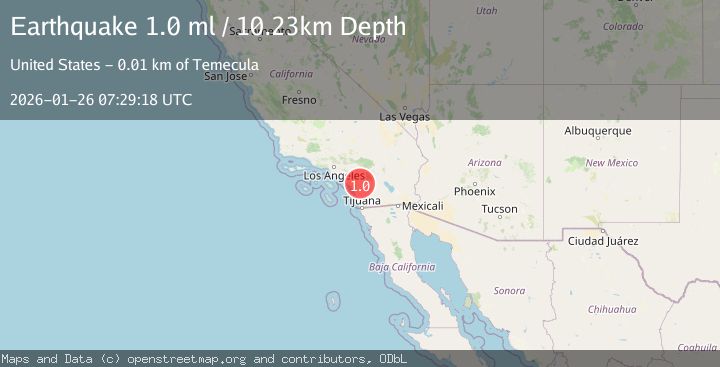
A 1.0 magnitude earthquake struck on 8 km ESE of Temecula, CA, at Mon, 26 Jan 2026 07:29:18 GMT. Depth: 10.2299995422363km. Reviewed by USGS seismologists, this minor quake occurred at a magnitude type of ml.
Magnitude
1.0
ml
Source
USGS
Intensity
-
Agency Reports
1 Sources| Source | Magnitude | Depth | Time |
|---|---|---|---|
| USGSPrimary | 1.0 | 10 km | 1 day ago |
Earthquake Details
AutomaticEvent IDusgs_ci41172495
Tsunami PotentialNo
Magnitude Typeml
Nearest Places
- San Gabriel Church1.7 km
- Pechanga Reservation1.8 km
- Pechanga Fire Department Station 1771.9 km
- Temecula Ranchos1.9 km
- Pechanga Tribal Park2.0 km
Comments
Join the discussion about this event.
Latest Earthquakes
3.5Mag
Southern Sumatra, Indonesia
Time6 minutes ago
Depth71.54 km
SourceBMKG (Automatic)
1.7Mag
20 km SW of Jal, New Mexico
Time9 minutes ago
Depth1.84 km
SourceUSGS (Automatic)
2.8Mag
Minahassa Peninsula, Sulawesi
Time15 minutes ago
Depth25.02 km
SourceBMKG (Automatic)
2.6Mag
Sumbawa Region, Indonesia
Time21 minutes ago
Depth125.03 km
SourceBMKG (Automatic)
2.3Mag
NORTHERN ITALY
Time21 minutes ago
Depth14.00 km
SourceOGS (Automatic)
Nearby Earthquakes
2.0Mag
11 km NW of Aguanga, CA
Time4 days ago
Depth2.89 km
SourceUSGS (Automatic)
0.9Mag
10 km SSW of Valle Vista, CA
Time4 hours ago
Depth15.42 km
SourceUSGS (Automatic)
1.0Mag
6 km WSW of Anza, CA
Time21 hours ago
Depth4.44 km
SourceUSGS (Automatic)
1.9Mag
5 km WSW of Anza, CA
Time1 day ago
Depth7.14 km
SourceUSGS (Automatic)
1.1Mag
7 km SE of Valle Vista, CA
Time12 hours ago
Depth15.56 km
SourceUSGS (Automatic)