Earthquake 23 km SSW of La Quinta, CA
Mon, 26 Jan 2026 11:53:17 GMT
Time22 hours ago
Location
33.4832, -116.4307
Depth
14.1 KM
Event Summary
A 1.4 magnitude earthquake struck on 23 km SSW of La Quinta, CA, at Mon, 26 Jan 2026 11:53:17 GMT. Depth: 14.11km. Reviewed by USGS seismologists, this minor quake occurred at a magnitude type of ml.
Magnitude
1.4
ml
Source
USGS
Intensity
-
Agency Reports
1 Sources| Source | Magnitude | Depth | Time |
|---|---|---|---|
| USGSPrimary | 1.4 | 12 km | 22 hours ago |
Earthquake Details
AutomaticEvent IDusgs_ci41172591
Tsunami PotentialNo
Magnitude Typeml
Nearest Places
- Toro Spring2.3 km
- Nicholias Canyon2.5 km
- Buck Ridge3.5 km
- Alder Canyon4.3 km
- Toro Peak4.5 km
Comments
Join the discussion about this event.
Latest Earthquakes
4.3Mag
Sulawesi, Indonesia
Time13 hours ago
Depth10.00 km
SourceBMKG (Automatic)
2.6Mag
Minahassa Peninsula, Sulawesi
Time13 hours ago
Depth118.00 km
SourceBMKG (Automatic)
2.8Mag
South of Bali, Indonesia
Time13 hours ago
Depth10.00 km
SourceBMKG (Automatic)
1.7Mag
31 km SE of Denali National Park, Alaska
Time14 hours ago
Depth0.60 km
SourceUSGS (Automatic)
2.2Mag
WESTERN TURKEY
Time14 hours ago
Depth14.90 km
SourceKOERI (Automatic)
Nearby Earthquakes
2.3Mag
21 km SSW of La Quinta, CA
Time2 days ago
Depth9.31 km
SourceUSGS (Automatic)
1.4Mag
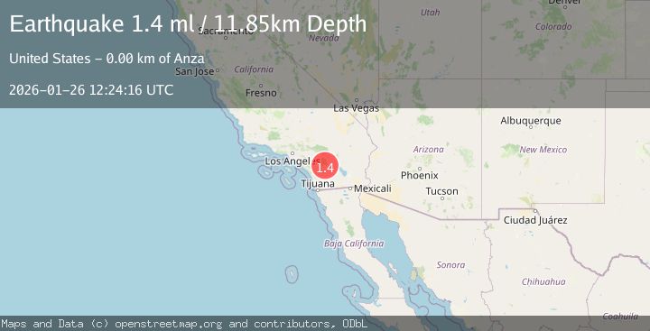
17 km ESE of Anza, CA
Time2 days ago
Depth13.29 km
SourceUSGS (Automatic)
1.9Mag
16 km ESE of Anza, CA
Time2 days ago
Depth13.37 km
SourceUSGS (Automatic)
1.2Mag
12 km N of Borrego Springs, CA
Time20 hours ago
Depth14.78 km
SourceUSGS (Automatic)
2.9Mag
13 km NNE of Borrego Springs, CA
Time5 days ago
Depth11.34 km
SourceUSGS (Automatic)