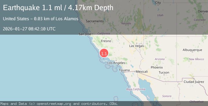
Earthquake 30 km NE of Los Alamos, CA
Tue, 27 Jan 2026 08:42:10 GMT
Time1 hour ago
Location
34.9632, -120.0840
Depth
4.2 KM
Event Summary
A 1.1 magnitude earthquake struck on 30 km NE of Los Alamos, CA, at Tue, 27 Jan 2026 08:42:10 GMT. Depth: 4.17000007629395km. Reviewed by USGS seismologists, this minor quake occurred at a magnitude type of ml.
Magnitude
1.1
ml
Source
USGS
Intensity
-
Agency Reports
1 Sources| Source | Magnitude | Depth | Time |
|---|---|---|---|
| USGSPrimary | 1.1 | 4 km | 1 hour ago |
Earthquake Details
AutomaticEvent IDusgs_ci41173511
Tsunami PotentialNo
Magnitude Typeml
Nearest Places
- Lazy Campground0.3 km
- Kerry Canyon1.1 km
- Smith Canyon1.2 km
- Wagon Flat Campground1.4 km
- White Elephant Mine1.9 km
Comments
Join the discussion about this event.
Latest Earthquakes
2.5Mag
Northern Sumatra, Indonesia
Time3 minutes ago
Depth0.60 km
SourceBMKG (Automatic)
2.1Mag
SOUTHERN TEXAS
Time4 minutes ago
Depth0.00 km
SourceTX (Automatic)
0.9Mag
EASTERN TURKEY
Time11 minutes ago
Depth6.80 km
SourceAFAD (Automatic)
2.4Mag
EASTERN TURKEY
Time14 minutes ago
Depth4.30 km
SourceKOERI (Automatic)
0.2Mag
6 km WNW of Cobb, CA
Time16 minutes ago
Depth1.56 km
SourceUSGS (Automatic)
Nearby Earthquakes
1.3Mag
25 km WSW of Maricopa, CA
Time16 hours ago
Depth2.92 km
SourceUSGS (Automatic)
1.9Mag
13 km NE of Carpinteria, CA
Time6 hours ago
Depth2.49 km
SourceUSGS (Automatic)
1.7Mag
5 km S of Carpinteria, CA
Time1 day ago
Depth3.45 km
SourceUSGS (Automatic)
1.2Mag
Central California
Time1 week ago
Depth5.93 km
SourceUSGS (Automatic)
1.8Mag
14 km S of Frazier Park, CA
Time3 days ago
Depth15.39 km
SourceUSGS (Automatic)