Earthquake 67 km WSW of Coronado, CA
Tue, 27 Jan 2026 15:48:58 GMT
Time5 hours ago
Location
32.3947, -117.8122
Depth
9.7 KM
Event Summary
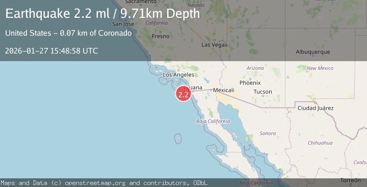
A 2.2 magnitude earthquake struck on 67 km WSW of Coronado, CA, at Tue, 27 Jan 2026 15:48:58 GMT. Depth: 9.71km. Reviewed by USGS seismologists, this minor quake occurred at a magnitude type of ml.
Magnitude
2.2
ml
Source
USGS
Intensity
-
Agency Reports
1 Sources| Source | Magnitude | Depth | Time |
|---|---|---|---|
| USGSPrimary | 2.2 | 10 km | 5 hours ago |
Earthquake Details
AutomaticEvent IDusgs_ci41173695
Tsunami PotentialNo
Magnitude Typeml
Nearest Places
- San Salvador Knoll13.4 km
- San Clemente Basin16.2 km
- Boundary Bank20.0 km
- Navy Bank27.6 km
- Thirtymile Bank30.4 km
Comments
Join the discussion about this event.
Latest Earthquakes
4.8Mag
Mindanao, Philippines
Time5 hours ago
Depth10.00 km
SourceBMKG (Automatic)
1.4Mag
38 km NW of Stanton, Texas
Time5 hours ago
Depth4.68 km
SourceUSGS (Automatic)
2.3Mag
Southern Sumatra, Indonesia
Time5 hours ago
Depth71.47 km
SourceBMKG (Automatic)
3.7Mag
Java, Indonesia
Time5 hours ago
Depth26.88 km
SourceBMKG (Automatic)
1.7Mag
20 km ENE of Arvin, CA
Time5 hours ago
Depth5.64 km
SourceUSGS (Automatic)
Nearby Earthquakes
2.0Mag
OFFSHORE BAJA CALIFORNIA, MEXICO
Time3 days ago
Depth19.00 km
SourceSCSN (Automatic)
1.6Mag
16 km WSW of Dana Point, CA
Time2 days ago
Depth12.63 km
SourceUSGS (Automatic)
1.8Mag
11 km WSW of Pine Valley, CA
Time3 days ago
Depth17.51 km
SourceUSGS (Automatic)
1.5Mag
11 km W of Pine Valley, CA
Time4 days ago
Depth17.33 km
SourceUSGS (Automatic)
1.7Mag
11 km W of Pine Valley, CA
Time4 days ago
Depth16.60 km
SourceUSGS (Automatic)