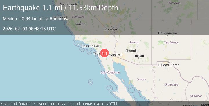
Earthquake 17 km NW of Ocotillo, CA
Tue, 03 Feb 2026 00:48:16 GMT
Time1 hour ago
Location
32.8498, -116.1075
Depth
11.5 KM
Event Summary
A 1.1 magnitude earthquake struck on 17 km NW of Ocotillo, CA, at Tue, 03 Feb 2026 00:48:16 GMT. Depth: 11.53km. Reviewed by USGS seismologists, this minor quake occurred at a magnitude type of ml.
Magnitude
1.1
ml
Source
USGS
Intensity
-
Agency Reports
1 Sources| Source | Magnitude | Depth | Time |
|---|---|---|---|
| USGSPrimary | 1.1 | 12 km | 1 hour ago |
Earthquake Details
AutomaticEvent IDusgs_ci41178663
Tsunami PotentialNo
Magnitude Typeml
Nearest Places
- Carrizo Badlands2.7 km
- Old Carrizo Stage Station2.9 km
- Canyon Nombre4.0 km
- Bow Willow Creek4.2 km
- Vallecito Creek4.3 km
Comments
Join the discussion about this event.
Latest Earthquakes
2.6Mag
West Papua Region, Indonesia
Time3 minutes ago
Depth33.31 km
SourceBMKG (Automatic)
4.4Mag
SOUTHERN PERU
Time26 minutes ago
Depth196.00 km
SourceLIM (Automatic)
2.0Mag
POLAND
Time31 minutes ago
Depth10.00 km
SourceIGPAS (Automatic)
3.0Mag
South of Java, Indonesia
Time43 minutes ago
Depth5.00 km
SourceBMKG (Automatic)
3.4Mag
OFFSHORE EL SALVADOR
Time44 minutes ago
Depth35.00 km
SourceINET (Automatic)
Nearby Earthquakes
1.1Mag
26 km WNW of Ocotillo, CA
Time2 days ago
Depth14.24 km
SourceUSGS (Automatic)
1.1Mag
28 km SSW of Ocotillo Wells, CA
Time9 hours ago
Depth8.27 km
SourceUSGS (Automatic)
1.2Mag
13 km ESE of Pine Valley, CA
Time1 day ago
Depth14.83 km
SourceUSGS (Automatic)
1.8Mag
24 km ESE of Julian, CA
Time1 week ago
Depth9.76 km
SourceUSGS (Automatic)
1.6Mag
24 km ESE of Julian, CA
Time1 week ago
Depth9.48 km
SourceUSGS (Automatic)