Earthquake 29 km W of Olancha, CA
Sun, 15 Feb 2026 14:51:11 GMT
Time3 days ago
Location
36.2457, -118.3308
Depth
4.4 KM
Event Summary
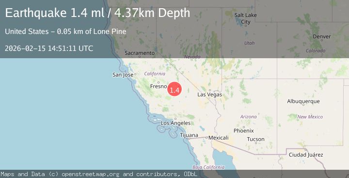
A 1.4 magnitude earthquake struck on 29 km W of Olancha, CA, at Sun, 15 Feb 2026 14:51:11 GMT. Depth: 4.36999988555908km. Reviewed by USGS seismologists, this minor quake occurred at a magnitude type of ml.
Magnitude
1.4
ml
Source
USGS
Intensity
-
Agency Reports
1 Sources| Source | Magnitude | Depth | Time |
|---|---|---|---|
| USGSPrimary | 1.4 | 4 km | 3 days ago |
Earthquake Details
AutomaticEvent IDusgs_ci41398560
Tsunami PotentialNo
Magnitude Typeml
Nearest Places
- West Stringer1.7 km
- Cold Creek2.0 km
- Soda Flat2.1 km
- Sidehill Meadow2.6 km
- Redrock Creek2.8 km
Comments
Join the discussion about this event.
Latest Earthquakes
2.0Mag
Tarapaca, Chile
Time31 minutes ago
Depth104.13 km
SourceVYT (Automatic)
2.0Mag
Tarapaca, Chile
Time34 minutes ago
Depth120.97 km
SourceVYT (Automatic)
0.2Mag
8 km W of Cobb, CA
Time35 minutes ago
Depth1.64 km
SourceUSGS (Automatic)
4.6Mag
Mindanao, Philippines
Time45 minutes ago
Depth62.27 km
SourceBMKG
2.9Mag
offshore Coquimbo, Chile
Time48 minutes ago
Depth80.08 km
SourceVYT (Automatic)
Nearby Earthquakes
1.6Mag
29 km W of Olancha, CA
Time1 week ago
Depth4.19 km
SourceUSGS (Automatic)
1.7Mag
21 km WSW of Olancha, CA
Time1 week ago
Depth6.99 km
SourceUSGS (Automatic)
3.0Mag
CENTRAL CALIFORNIA
Time11 years ago
Depth3.00 km
SourceNEIR (Automatic)
3.0Mag
CENTRAL CALIFORNIA
Time2 years ago
Depth5.00 km
SourceNEIC (Automatic)
4.0Mag
CENTRAL CALIFORNIA
Time5 years ago
Depth5.00 km
SourceNEIC (Automatic)