Earthquake 24 km N of Borrego Springs, CA
Sun, 15 Feb 2026 15:50:42 GMT
Time2 days ago
Location
33.4650, -116.4230
Depth
3.3 KM
Event Summary
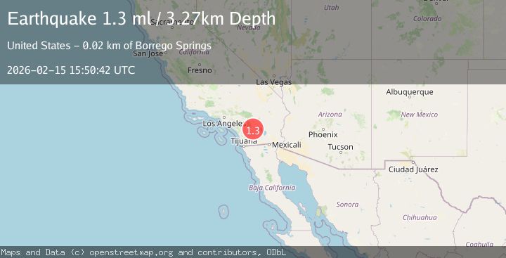
A 1.3 magnitude earthquake struck on 24 km N of Borrego Springs, CA, at Sun, 15 Feb 2026 15:50:42 GMT. Depth: 3.26999998092651km. Reviewed by USGS seismologists, this minor quake occurred at a magnitude type of ml.
Magnitude
1.3
ml
Source
USGS
Intensity
-
Agency Reports
1 Sources| Source | Magnitude | Depth | Time |
|---|---|---|---|
| USGSPrimary | 1.3 | 3 km | 2 days ago |
Earthquake Details
AutomaticEvent IDusgs_ci41398608
Tsunami PotentialNo
Magnitude Typeml
Nearest Places
- Nicholias Canyon1.3 km
- Buck Ridge1.6 km
- Alder Canyon3.0 km
- Dry Wash3.8 km
- Cottonwood Spring4.1 km
Comments
Join the discussion about this event.
Latest Earthquakes
1.6Mag
14 km W of Johannesburg, CA
Time9 hours ago
Depth2.16 km
SourceUSGS (Automatic)
2.0Mag
Antofagasta, Chile
Time9 hours ago
Depth140.75 km
SourceVYT (Automatic)
1.5Mag
California-Baja California border region
Time9 hours ago
Depth16.24 km
SourceVYT (Automatic)
1.1Mag
6 km NW of The Geysers, CA
Time9 hours ago
Depth1.72 km
SourceUSGS (Automatic)
1.8Mag
Central Alaska
Time9 hours ago
Depth0.00 km
SourceVYT (Automatic)
Nearby Earthquakes
1.2Mag
23 km N of Borrego Springs, CA
Time2 weeks ago
Depth5.12 km
SourceUSGS (Automatic)
1.2Mag
23 km N of Borrego Springs, CA
Time1 week ago
Depth3.28 km
SourceUSGS (Automatic)
3.0Mag
SOUTHERN CALIFORNIA
Time9 years ago
Depth11.00 km
SourceNEIC (Automatic)
1.0Mag
24 km ESE of Anza, CA
Time2 weeks ago
Depth3.61 km
SourceUSGS (Automatic)
1.4Mag
23 km SSW of La Quinta, CA
Time1 week ago
Depth12.80 km
SourceUSGS (Automatic)