Earthquake 23 km SSW of La Quinta, CA
Sun, 08 Feb 2026 01:02:28 GMT
Time1 hour ago
Location
33.4707, -116.4082
Depth
12.8 KM
Event Summary
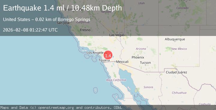
A 1.4 magnitude earthquake struck on 23 km SSW of La Quinta, CA, at Sun, 08 Feb 2026 01:02:28 GMT. Depth: 12.8000001907349km. Reviewed by USGS seismologists, this minor quake occurred at a magnitude type of ml.
Magnitude
1.4
ml
Source
USGS
Intensity
-
Agency Reports
1 Sources| Source | Magnitude | Depth | Time |
|---|---|---|---|
| USGSPrimary | 1.4 | 10 km | 1 hour ago |
Earthquake Details
AutomaticEvent IDusgs_ci41393672
Tsunami PotentialNo
Magnitude Typeml
Nearest Places
- Nicholias Canyon0.2 km
- Buck Ridge1.3 km
- Alder Canyon1.9 km
- Old Santa Rosa Indian Ruins2.9 km
- Cottonwood Spring3.0 km
Comments
Join the discussion about this event.
Latest Earthquakes
1.7Mag
23 km W of Cohoe, Alaska
Time16 minutes ago
Depth75.40 km
SourceUSGS (Automatic)
0.7Mag
NORTHERN ITALY
Time20 minutes ago
Depth6.40 km
SourceETHZ (Automatic)
0.5Mag
9 km ESE of Valle Vista, CA
Time24 minutes ago
Depth16.04 km
SourceUSGS (Automatic)
4.9Mag
NEAR EAST COAST OF HONSHU, JAPAN
Time28 minutes ago
Depth35.00 km
SourceNEIC (Automatic)
2.6Mag
SOUTHERN YUKON TERRITORY, CANADA
Time42 minutes ago
Depth5.00 km
SourceNEIC (Automatic)
Nearby Earthquakes
1.2Mag
23 km N of Borrego Springs, CA
Time6 days ago
Depth5.12 km
SourceUSGS (Automatic)
1.4Mag
23 km SSW of La Quinta, CA
Time1 week ago
Depth14.11 km
SourceUSGS (Automatic)
1.0Mag
24 km ESE of Anza, CA
Time1 week ago
Depth3.61 km
SourceUSGS (Automatic)
2.3Mag
21 km SSW of La Quinta, CA
Time2 weeks ago
Depth9.31 km
SourceUSGS (Automatic)
1.4Mag
21 km SW of La Quinta, CA
Time4 days ago
Depth7.54 km
SourceUSGS (Automatic)