Earthquake 5 km WSW of Anza, CA
Tue, 17 Feb 2026 11:02:02 GMT
Time1 day ago
Location
33.5327, -116.7205
Depth
7.1 KM
Event Summary
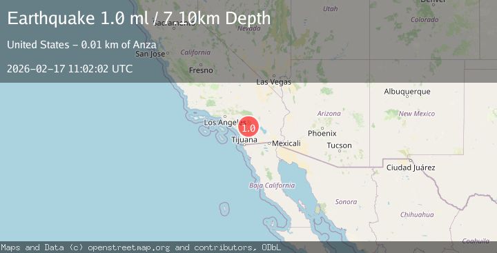
A 1.0 magnitude earthquake struck on 5 km WSW of Anza, CA, at Tue, 17 Feb 2026 11:02:02 GMT. Depth: 7.09999990463257km. Reviewed by USGS seismologists, this minor quake occurred at a magnitude type of ml.
Magnitude
1.0
ml
Source
USGS
Intensity
-
Agency Reports
1 Sources| Source | Magnitude | Depth | Time |
|---|---|---|---|
| USGSPrimary | 1.0 | 7 km | 1 day ago |
Earthquake Details
AutomaticEvent IDusgs_ci41399232
Tsunami PotentialNo
Magnitude Typeml
Nearest Places
- Durasno Valley0.9 km
- Cahuilla Reservation1.6 km
- Cahuilla2.4 km
- Cave Rocks3.2 km
- American Medical Response Anza4.3 km
Comments
Join the discussion about this event.
Latest Earthquakes
2.4Mag
Finland-Russia border region
Time1 minute ago
Depth341.92 km
SourceVYT (Automatic)
0.9Mag
8 km W of Cobb, CA
Time6 minutes ago
Depth1.53 km
SourceUSGS (Automatic)
1.8Mag
Central Alaska
Time9 minutes ago
Depth2.08 km
SourceVYT (Automatic)
2.9Mag
WESTERN TURKEY
Time12 minutes ago
Depth11.80 km
SourceKOERI (Automatic)
2.8Mag
Sulawesi, Indonesia
Time12 minutes ago
Depth21.08 km
SourceBMKG
Nearby Earthquakes
1.9Mag
5 km WSW of Anza, CA
Time3 weeks ago
Depth7.14 km
SourceUSGS (Automatic)
0.4Mag
5 km WSW of Anza, CA
Time1 week ago
Depth5.98 km
SourceUSGS (Automatic)
0.4Mag
5 km WSW of Anza, CA
Time2 weeks ago
Depth5.70 km
SourceUSGS (Automatic)
1.1Mag
6 km WSW of Anza, CA
Time3 weeks ago
Depth6.26 km
SourceUSGS (Automatic)
0.4Mag
6 km WSW of Anza, CA
Time4 days ago
Depth3.66 km
SourceUSGS (Automatic)