Earthquake 25 km SSW of Ocotillo Wells, CA
Fri, 20 Feb 2026 11:04:43 GMT
Time2 hours ago
Location
32.9303, -116.2268
Depth
12.8 KM
Event Summary
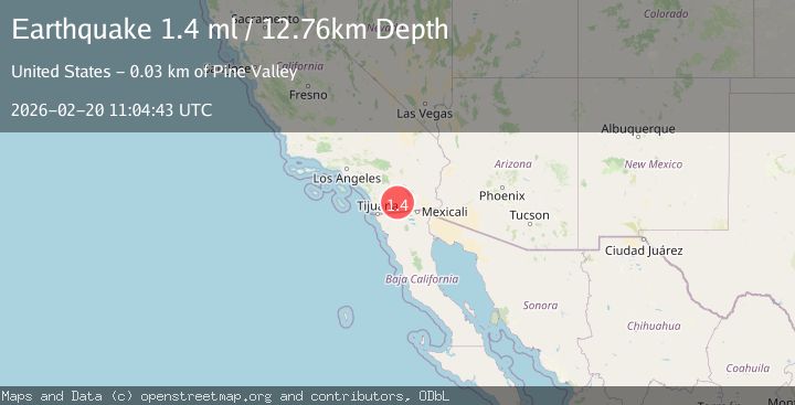
A 1.4 magnitude earthquake struck on 25 km SSW of Ocotillo Wells, CA, at Fri, 20 Feb 2026 11:04:43 GMT. Depth: 12.7600002288818km. Reviewed by USGS seismologists, this minor quake occurred at a magnitude type of ml.
Magnitude
1.4
ml
Source
USGS
Intensity
-
Agency Reports
1 Sources| Source | Magnitude | Depth | Time |
|---|---|---|---|
| USGSPrimary | 1.4 | 13 km | 2 hours ago |
Earthquake Details
AutomaticEvent IDusgs_ci41400360
Tsunami PotentialNo
Magnitude Typeml
Nearest Places
- View of Badland1.0 km
- Southern Overland Trail Cultural Preserve1.4 km
- Mesquite Oasis1.4 km
- Palm Spring1.4 km
- Canebrake Wash1.6 km
Comments
Join the discussion about this event.
Latest Earthquakes
2.0Mag
northwestern Russia
Time2 hours ago
Depth0.00 km
SourceVYT (Automatic)
4.7Mag
Molucca Sea
Time2 hours ago
Depth0.00 km
SourceVYT (Automatic)
1.3Mag
Central Alaska
Time2 hours ago
Depth10.00 km
SourceVYT (Automatic)
2.2Mag
FRANCE
Time2 hours ago
Depth5.00 km
SourceReNaSS (Automatic)
2.3Mag
Minahassa Peninsula, Sulawesi
Time2 hours ago
Depth10.00 km
SourceBMKG
Nearby Earthquakes
1.1Mag
28 km SSW of Ocotillo Wells, CA
Time2 weeks ago
Depth8.27 km
SourceUSGS (Automatic)
3.0Mag
SOUTHERN CALIFORNIA
Time9 years ago
Depth6.00 km
SourceNEIR (Automatic)
3.0Mag
SOUTHERN CALIFORNIA
Time8 years ago
Depth10.00 km
SourceNEIR (Automatic)
2.1Mag
SOUTHERN CALIFORNIA
Time1 month ago
Depth9.10 km
SourceSCSN (Automatic)
1.4Mag
26 km NW of Ocotillo, CA
Time2 weeks ago
Depth10.03 km
SourceUSGS (Automatic)