Earthquake 27 km WSW of Progreso, B.C., MX
Mon, 23 Feb 2026 11:29:13 GMT
Time2 hours ago
Location
32.4655, -115.8383
Depth
10.9 KM
Event Summary
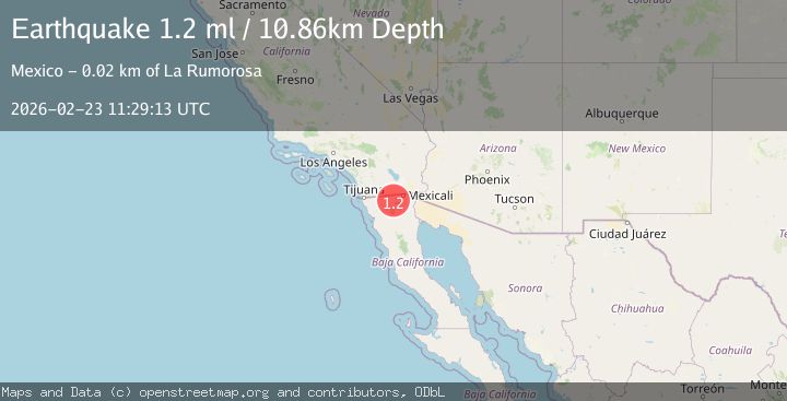
A 1.2 magnitude earthquake struck on 27 km WSW of Progreso, B.C., MX, at Mon, 23 Feb 2026 11:29:13 GMT. Depth: 10.86km. Reviewed by USGS seismologists, this minor quake occurred at a magnitude type of ml.
Magnitude
1.2
ml
Source
USGS
Intensity
-
Agency Reports
1 Sources| Source | Magnitude | Depth | Time |
|---|---|---|---|
| USGSPrimary | 1.2 | 11 km | 2 hours ago |
Earthquake Details
AutomaticEvent IDusgs_ci41401928
Tsunami PotentialNo
Magnitude Typeml
Nearest Places
- 2.0 km
- 6.1 km
- 8.4 km
- 9.1 km
- 9.4 km
Comments
Join the discussion about this event.
Latest Earthquakes
0.7Mag
Southern Alaska
Time2 hours ago
Depth19.65 km
SourceVYT (Automatic)
2.1Mag
Finland
Time2 hours ago
Depth2.32 km
SourceVYT (Automatic)
2.3Mag
Tarapaca, Chile
Time2 hours ago
Depth108.52 km
SourceVYT (Automatic)
2.8Mag
Fox Islands, Aleutian Islands, Alaska
Time2 hours ago
Depth0.00 km
SourceVYT (Automatic)
2.7Mag
Minahasa, Sulawesi, Indonesia
Time2 hours ago
Depth119.87 km
SourceVYT (Automatic)
Nearby Earthquakes
2.0Mag
California-Baja California border region
Time6 days ago
Depth15.26 km
SourceVYT (Automatic)
2.0Mag
California-Baja California border region
Time1 week ago
Depth30.15 km
SourceVYT (Automatic)
1.4Mag
9 km WSW of Progreso, B.C., MX
Time2 weeks ago
Depth6.57 km
SourceUSGS (Automatic)
5.8Mag
BAJA CALIFORNIA, MEXICO
Time15 years ago
Depth10.00 km
SourceEMSC (Automatic)
1.4Mag
9 km SW of Progreso, B.C., MX
Time1 week ago
Depth3.83 km
SourceUSGS (Automatic)