Earthquake California-Baja California border region
Tue, 17 Feb 2026 01:11:53 GMT
Time2 days ago
Location
32.5226, -115.8021
Depth
15.3 KM
Event Summary
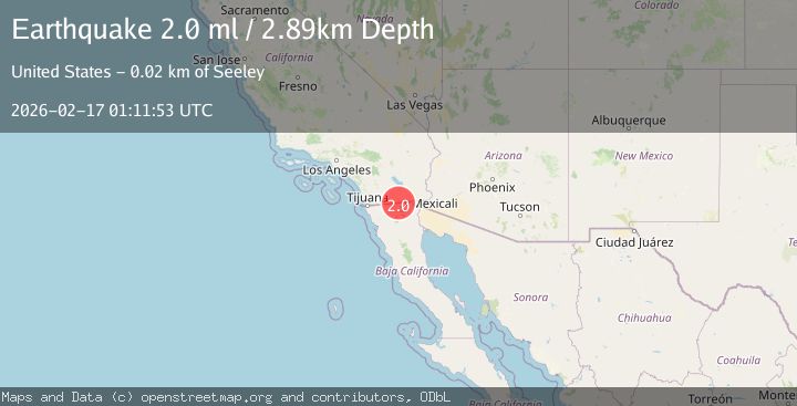
A 2.0 magnitude earthquake struck on California-Baja California border region, at Tue, 17 Feb 2026 01:11:53 GMT. Depth: 15.2587890625km. Reviewed by VYT seismologists, this minor quake occurred at a magnitude type of earthquake.
Magnitude
2.0
earthquake
Source
VYT
Intensity
-
Agency Reports
2 Sources| Source | Magnitude | Depth | Time |
|---|---|---|---|
| VYTPrimary | 1.8 | 15 km | 2 days ago |
| USGS | 2.0 | 3 km | 2 days ago |
Earthquake Details
AutomaticEvent IDvyt_1u45gsxca1agm
Tsunami PotentialNo
Magnitude Typeearthquake
Nearest Places
- Pozo Salado3.5 km
- Pozo del Tule4.5 km
- San Antonio4.8 km
- Aguaje del Laretto4.9 km
- Rancho San Antonio5.5 km
Comments
Join the discussion about this event.
Latest Earthquakes
5.0Mag
Andreanof Islands, Aleutian Islands, Alaska
Time8 hours ago
Depth132.32 km
SourceVYT (Automatic)
1.6Mag
Southeastern Alaska
Time8 hours ago
Depth10.13 km
SourceVYT (Automatic)
2.8Mag
Southern California
Time8 hours ago
Depth5.37 km
SourceVYT (Automatic)
2.7Mag
Java, Indonesia
Time8 hours ago
Depth14.57 km
SourceBMKG
0.7Mag
3 km NNW of The Geysers, CA
Time8 hours ago
Depth2.60 km
SourceUSGS (Automatic)
Nearby Earthquakes
1.4Mag
9 km WSW of Progreso, B.C., MX
Time1 week ago
Depth6.57 km
SourceUSGS (Automatic)
3.0Mag
BAJA CALIFORNIA, MEXICO
Time5 months ago
Depth10.00 km
SourceNEIC (Automatic)
2.0Mag
15 km WNW of Progreso, B.C., MX
Time1 week ago
Depth7.53 km
SourceUSGS (Automatic)
1.4Mag
9 km SW of Progreso, B.C., MX
Time3 days ago
Depth3.83 km
SourceUSGS (Automatic)
3.0Mag
BAJA CALIFORNIA, MEXICO
Time11 years ago
Depth9.00 km
SourceNEIR (Automatic)