Earthquake 6 km NE of Mexicali, B.C., MX
Wed, 04 Mar 2026 07:37:37 GMT
Time5 hours ago
Location
32.6932, -115.4317
Depth
14.4 KM
Event Summary
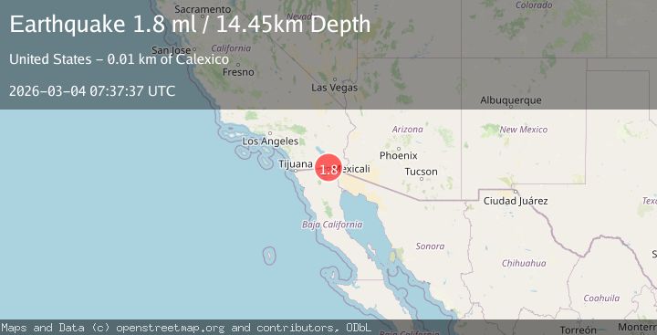
A 1.8 magnitude earthquake struck on 6 km NE of Mexicali, B.C., MX, at Wed, 04 Mar 2026 07:37:37 GMT. Depth: 14.4499998092651km. Reviewed by USGS seismologists, this minor quake occurred at a magnitude type of ml.
Magnitude
1.8
ml
Source
USGS
Intensity
-
Agency Reports
1 Sources| Source | Magnitude | Depth | Time |
|---|---|---|---|
| USGSPrimary | 1.8 | 14 km | 5 hours ago |
Earthquake Details
AutomaticEvent IDusgs_ci41408888
Tsunami PotentialNo
Magnitude Typeml
Nearest Places
- 0.8 km
- 0.9 km
- 1.2 km
- 1.2 km
- 1.4 km
Comments
Join the discussion about this event.
Latest Earthquakes
1.7Mag
26 km NNW of Fishhook, Alaska
Time5 hours ago
Depth50.10 km
SourceUSGS (Automatic)
3.7Mag
Andreanof Islands, Aleutian Islands, Alaska
Time5 hours ago
Depth0.24 km
SourceVYT (Automatic)
3.5Mag
OFF E. COAST OF N. ISLAND, N.Z.
Time5 hours ago
Depth100.00 km
SourceGNS (Automatic)
1.3Mag
12 km SSE of Anza, CA
Time5 hours ago
Depth8.83 km
SourceUSGS (Automatic)
2.6Mag
Central Alaska
Time5 hours ago
Depth127.56 km
SourceVYT (Automatic)
Nearby Earthquakes
1.6Mag
6 km NE of Calexico, CA
Time22 hours ago
Depth15.86 km
SourceUSGS (Automatic)
1.8Mag
4 km ESE of Heber, CA
Time5 days ago
Depth11.29 km
SourceUSGS (Automatic)
1.4Mag
7 km SW of Holtville, CA
Time1 month ago
Depth12.18 km
SourceUSGS (Automatic)
1.8Mag
4 km NW of Calexico, CA
Time4 days ago
Depth3.69 km
SourceUSGS (Automatic)
1.3Mag
8 km WSW of Holtville, CA
Time1 month ago
Depth7.17 km
SourceUSGS (Automatic)