Earthquake 2 km SSW of Mexicali, B.C., MX
Wed, 04 Mar 2026 08:48:00 GMT
Time2 hours ago
Location
32.6310, -115.4772
Depth
9.3 KM
Event Summary
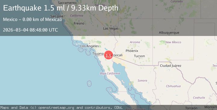
A 1.5 magnitude earthquake struck on 2 km SSW of Mexicali, B.C., MX, at Wed, 04 Mar 2026 08:48:00 GMT. Depth: 9.32999992370605km. Reviewed by USGS seismologists, this minor quake occurred at a magnitude type of ml.
Magnitude
1.5
ml
Source
USGS
Intensity
-
Agency Reports
1 Sources| Source | Magnitude | Depth | Time |
|---|---|---|---|
| USGSPrimary | 1.5 | 9 km | 2 hours ago |
Earthquake Details
AutomaticEvent IDusgs_ci41408912
Tsunami PotentialNo
Magnitude Typeml
Nearest Places
- 1.2 km
- 1.6 km
- 1.6 km
- 1.6 km
- 1.7 km
Comments
Join the discussion about this event.
Latest Earthquakes
1.5Mag
30 km NW of Toyah, Texas
Time2 hours ago
Depth4.47 km
SourceUSGS (Automatic)
2.0Mag
Nevada
Time2 hours ago
Depth15.50 km
SourceVYT (Automatic)
1.3Mag
Southern Alaska
Time2 hours ago
Depth33.81 km
SourceVYT (Automatic)
2.0Mag
Alaska Peninsula
Time2 hours ago
Depth5.25 km
SourceVYT (Automatic)
1.6Mag
Southern California
Time2 hours ago
Depth16.24 km
SourceVYT (Automatic)
Nearby Earthquakes
3.0Mag
BAJA CALIFORNIA, MEXICO
Time4 years ago
Depth10.00 km
SourceEMSC (Automatic)
1.8Mag
6 km NE of Mexicali, B.C., MX
Time3 hours ago
Depth14.45 km
SourceUSGS (Automatic)
1.8Mag
4 km NW of Calexico, CA
Time4 days ago
Depth3.69 km
SourceUSGS (Automatic)
1.6Mag
6 km NE of Calexico, CA
Time20 hours ago
Depth15.86 km
SourceUSGS (Automatic)
1.8Mag
4 km ESE of Heber, CA
Time5 days ago
Depth11.29 km
SourceUSGS (Automatic)