Earthquake 10 km E of Waimea, Hawaii
Thu, 29 Jan 2026 04:45:16 GMT
Time7 hours ago
Location
20.0282, -155.5753
Depth
33.4 KM
Event Summary
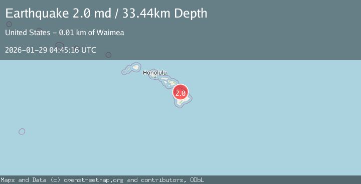
A 2.0 magnitude earthquake struck on 10 km E of Waimea, Hawaii, at Thu, 29 Jan 2026 04:45:16 GMT. Depth: 33.439998626709km. Reviewed by USGS seismologists, this minor quake occurred at a magnitude type of md.
Magnitude
2.0
md
Source
USGS
Intensity
-
Agency Reports
1 Sources| Source | Magnitude | Depth | Time |
|---|---|---|---|
| USGSPrimary | 2.0 | 33 km | 7 hours ago |
Earthquake Details
AutomaticEvent IDusgs_hv74887872
Tsunami PotentialNo
Magnitude Typemd
Nearest Places
- Kamoku1.0 km
- Puu Kikoni Dairy2.2 km
- Puukapu Reservoir2.6 km
- Puu Waiko Loa2.7 km
- Poo Kanaka2.9 km
Comments
Join the discussion about this event.
Latest Earthquakes
2.8Mag
Timor Region
Time1 hour ago
Depth10.00 km
SourceBMKG (Automatic)
3.0Mag
Java, Indonesia
Time1 hour ago
Depth26.40 km
SourceBMKG (Automatic)
2.1Mag
WESTERN TURKEY
Time1 hour ago
Depth3.90 km
SourceKOERI (Automatic)
1.6Mag
WESTERN TURKEY
Time1 hour ago
Depth8.30 km
SourceAFAD (Automatic)
2.4Mag
FRANCE
Time1 hour ago
Depth5.00 km
SourceReNaSS (Automatic)
Nearby Earthquakes
1.9Mag
14 km SSW of Puako, Hawaii
Time4 days ago
Depth27.16 km
SourceUSGS (Automatic)
1.8Mag
10 km WSW of Pepeekeo, Hawaii
Time2 days ago
Depth36.48 km
SourceUSGS (Automatic)
2.1Mag
ISLAND OF HAWAII, HAWAII
Time2 days ago
Depth-3.40 km
SourceHV (Automatic)
2.2Mag
ISLAND OF HAWAII, HAWAII
Time1 week ago
Depth-0.20 km
SourceHV (Automatic)
2.1Mag
ISLAND OF HAWAII, HAWAII
Time6 days ago
Depth6.60 km
SourceHV (Automatic)