Earthquake 22 km SE of Naalehu, Hawaii
Thu, 29 Jan 2026 12:29:28 GMT
Time1 hour ago
Location
18.9295, -155.4283
Depth
37.5 KM
Event Summary
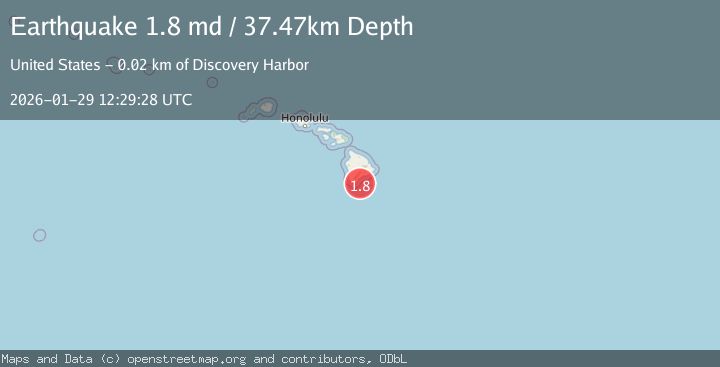
A 1.8 magnitude earthquake struck on 22 km SE of Naalehu, Hawaii, at Thu, 29 Jan 2026 12:29:28 GMT. Depth: 37.4700012207031km. Reviewed by USGS seismologists, this minor quake occurred at a magnitude type of md.
Magnitude
1.8
md
Source
USGS
Intensity
-
Agency Reports
1 Sources| Source | Magnitude | Depth | Time |
|---|---|---|---|
| USGSPrimary | 1.8 | 37 km | 1 hour ago |
Earthquake Details
AutomaticEvent IDusgs_hv74888262
Tsunami PotentialNo
Magnitude Typemd
Nearest Places
- Loihi Seamount17.0 km
- Naalehu Beach18.2 km
- Māniania Pali18.3 km
- Kaluahonu18.3 km
- Kaluaokalani18.3 km
Comments
Join the discussion about this event.
Latest Earthquakes
2.4Mag
Minahassa Peninsula, Sulawesi
Time4 minutes ago
Depth41.66 km
SourceBMKG (Automatic)
1.1Mag
5 km W of Cobb, CA
Time7 minutes ago
Depth1.84 km
SourceUSGS (Automatic)
2.3Mag
Sumbawa Region, Indonesia
Time8 minutes ago
Depth24.84 km
SourceBMKG (Automatic)
1.6Mag
7 km NNE of Coso Junction, CA
Time14 minutes ago
Depth3.84 km
SourceUSGS (Automatic)
1.8Mag
22 km SSE of Eureka Roadhouse, Alaska
Time19 minutes ago
Depth35.50 km
SourceUSGS (Automatic)
Nearby Earthquakes
1.9Mag
20 km SE of Naalehu, Hawaii
Time1 day ago
Depth34.08 km
SourceUSGS (Automatic)
1.9Mag
18 km ESE of Naalehu, Hawaii
Time5 days ago
Depth42.58 km
SourceUSGS (Automatic)
2.2Mag
HAWAII REGION, HAWAII
Time5 days ago
Depth39.50 km
SourceHV (Automatic)
2.3Mag
23 km ESE of Naalehu, Hawaii
Time5 days ago
Depth28.64 km
SourceUSGS (Automatic)
1.9Mag
23 km ESE of Naalehu, Hawaii
Time6 days ago
Depth31.27 km
SourceUSGS (Automatic)