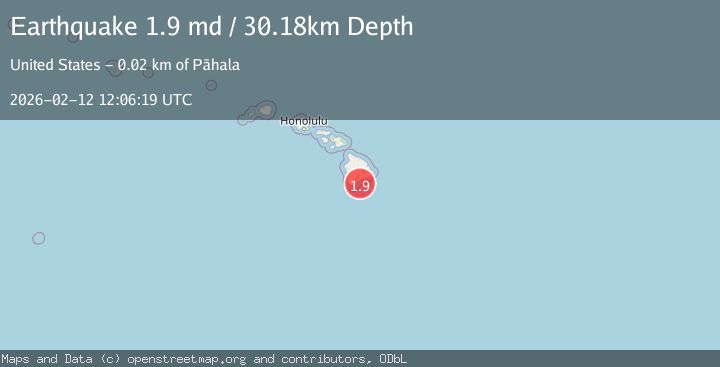
Earthquake 21 km SE of Pāhala, Hawaii
Thu, 12 Feb 2026 12:06:19 GMT
Time1 week ago
Location
19.0425, -155.3635
Depth
30.2 KM
Event Summary
A 1.9 magnitude earthquake struck on 21 km SE of Pāhala, Hawaii, at Thu, 12 Feb 2026 12:06:19 GMT. Depth: 30.1800003051758km. Reviewed by USGS seismologists, this minor quake occurred at a magnitude type of md.
Magnitude
1.9
md
Source
USGS
Intensity
-
Agency Reports
1 Sources| Source | Magnitude | Depth | Time |
|---|---|---|---|
| USGSPrimary | 1.9 | 30 km | 1 week ago |
Earthquake Details
AutomaticEvent IDusgs_hv74898042
Tsunami PotentialNo
Magnitude Typemd
Nearest Places
- Papau Seamount13.1 km
- Ahole Heiau13.7 km
- Palima Point15.0 km
- Waioala Spring15.0 km
- Pueo15.3 km
Comments
Join the discussion about this event.
Latest Earthquakes
2.1Mag
Tarapaca, Chile
Time20 hours ago
Depth110.35 km
SourceVYT (Automatic)
2.1Mag
Southern Alaska
Time20 hours ago
Depth19.90 km
SourceVYT (Automatic)
1.5Mag
Seattle-Tacoma urban area, Washington
Time20 hours ago
Depth27.95 km
SourceVYT (Automatic)
2.4Mag
FRANCE
Time20 hours ago
Depth2.70 km
SourceIGN (Automatic)
3.2Mag
Antofagasta, Chile
Time20 hours ago
Depth149.90 km
SourceVYT (Automatic)
Nearby Earthquakes
1.8Mag
21 km SSE of Pāhala, Hawaii
Time5 days ago
Depth31.08 km
SourceUSGS (Automatic)
2.0Mag
21 km SSE of Pāhala, Hawaii
Time3 weeks ago
Depth30.78 km
SourceUSGS (Automatic)
1.8Mag
20 km SSE of Pāhala, Hawaii
Time6 days ago
Depth33.45 km
SourceUSGS (Automatic)
1.9Mag
21 km SE of Pāhala, Hawaii
Time1 week ago
Depth33.49 km
SourceUSGS (Automatic)
1.7Mag
21 km SE of Pāhala, Hawaii
Time3 weeks ago
Depth34.15 km
SourceUSGS (Automatic)